Río Tercero (Ctalamochita)
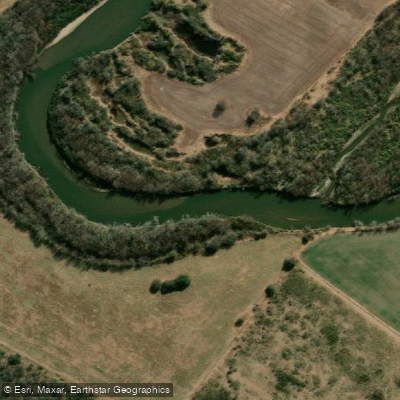
Río Tercero (Ctalamochita)
- Boat Ramps
- 1
- Access Points
- 0
- Campsites
- 7
The Río Tercero (Ctalamochita) originates in the Sierras de Córdoba near Cerro Champaquí and flows through the Valle de Calamuchita before crossing the plains, covering 307 kilometres before joining the Carcarañá River. Its drainage basin spans approximately 21,000 square kilometres, and mean flow is around 21–27 cubic metres per second. The river's name "Tercero" dates to the 18th century, when it was counted as the third river south of Córdoba city; "Ctalamochita" is believed to derive from a Native American word meaning "area of many trees." In 1984, the provincial legislature formally adopted the combined name Río Tercero (Ctalamochita).
Four dams along the river — Cerro Pelado, Arroyo Corto, Embalse Río Tercero (also called Dique Ministro Pistarini, completed in 1936 and covering 54.3 square kilometres), and Piedras Moras (inaugurated 1979, covering 600–900 hectares with a maximum depth of 34 metres) — regulate flow and generate hydroelectricity. These reservoirs are also used for water sports and tourism. The Piedras Moras Reservoir sits 2 km from the town of Almafuerte and 101 km from Córdoba city via Provincial Route 6.
For paddlers, kayak routes include a traverse of the Contraembalse Arroyo Corto in the Valle de Calamuchita, a roughly 16-kilometre out-and-back trip with an estimated six hours of paddling and trekking. A multi-day river journey from Almafuerte to Villa María covering approximately 110 kilometres has been undertaken, with paddlers camping on the riverbanks over three days. Water levels should be checked before attempting the Río Tercero–Villa María stretch. The river corridor passes near the towns of Amboy, Villa Amancay, and Embalse, offering mountain scenery and riparian vegetation.
The river supports notable biodiversity, including native fish species such as dorado and tararira. Sport fishing — both wading and float fishing — is actively practiced along accessible stretches, with mandatory catch-and-release rules in place for dorado. The surrounding riparian habitat sustains birds, mammals, and amphibians, though the river faces pressures from contamination and habitat degradation. The best season for water-based activities on the reservoirs is summer and early autumn; at Piedras Moras, winter water temperatures drop to around 10 °C.
Water access, boat ramps & amenities
Learn how to get on Río Tercero (Ctalamochita). Uncover great paddling access points, boat ramps, and all the facilities you need for an unforgettable day on the water. Some locations shown may border or include private property. Always check property boundaries and applicable regulations before visiting. PaddleWays's Public & Private Land layer can help you plan your access with confidence.
Paddle smarter with real-time insights
Whether you're en route and conditions shift or you're looking for the best spot based on current flows, we enable you to make informed decisions on the fly.







Córdoba licenses and regulations

Find Places to Paddle

Over 400,000 Places to Paddle
Every user gets free access to launch points, boat ramps, and public property parcels.


Water and weather conditions (10 day forecast)
See the best times to paddle Río Tercero (Ctalamochita) and check the forecast before you go.
Tercero - Piedras Moras
All Flow Stations
Paddling near Río Tercero (Ctalamochita)
Explore Córdoba waters
Top paddling waters
No waters available right now.
Popular Cities
Loading popular cities...
Explore near Río Tercero (Ctalamochita)
Access points
Nearby waters
More in Córdoba

Smarter Paddling Starts in the App.
Paddleways gives you everything you need to plan smarter, paddle better, and own every trip from first launch to takeout.