Río Amarillo
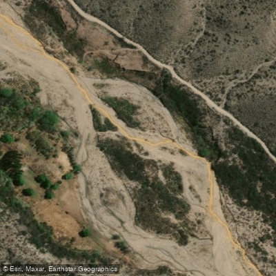
Río Amarillo
- Boat Ramps
- 0
- Access Points
- 0
- Campsites
- 0
The Río Amarillo is located approximately 16 kilometers from Chilecito in the province of La Rioja, Argentina. Access is via Provincial Route 14, which involves roughly 12 kilometers of unpaved gravel road (ripio), making a suitable vehicle advisable. From the road's end, visitors walk about 200 meters to reach the most notable feature of the river.
The river originates on Cerro Famatina and is also known locally as the Río de Oro. Its defining characteristic is its intense ochre-yellow color, produced by iron oxide and other minerals — including lead, copper, and zinc — carried downstream from the old La Mejicana gold mine on Cerro Famatina. The coloration intensifies further downstream as iron continues to oxidize. Heavy metals are present in the water column, dispersed for up to approximately 40 kilometers below the surface, which raises significant water quality concerns for any direct contact.
The river's most striking feature is its confluence with the Río Negro, which descends from the Quebrada del Agua Negra and carries notably clear, turquoise water. At the meeting point, the two rivers run side by side with a sharply defined color boundary, the yellow and clear waters traveling several meters before fully mixing. This confluence is the primary draw for visitors to the area and is the focal point of organized excursions, such as those offered by local operators like Eco Aventura La Rioja.
The surrounding landscape consists of arid mountain terrain with rocky formations typical of La Rioja. The river corridor passes through the foothills of the Famatina range. The road to the La Mejicana mine higher up the mountain crosses the Río Amarillo's channel more than 35 times, with the upper section of that route running directly through the riverbed itself — a detail relevant to anyone considering travel further into the drainage.
Given the documented presence of heavy metals including lead, copper, and zinc in the water, paddlers should treat direct water contact with caution. No specific paddling infrastructure, put-in points, or regulated paddling routes are documented for this river.
Water access, boat ramps & amenities
Learn how to get on Río Amarillo. Uncover great paddling access points, boat ramps, and all the facilities you need for an unforgettable day on the water. Some locations shown may border or include private property. Always check property boundaries and applicable regulations before visiting. PaddleWays's Public & Private Land layer can help you plan your access with confidence.
Paddle smarter with real-time insights
Whether you're en route and conditions shift or you're looking for the best spot based on current flows, we enable you to make informed decisions on the fly.







La Rioja licenses and regulations

Find Places to Paddle

Over 400,000 Places to Paddle
Every user gets free access to launch points, boat ramps, and public property parcels.


Water and weather conditions (10 day forecast)
See the best times to paddle Río Amarillo and check the forecast before you go.
No forecast data available.
Explore La Rioja waters
Top paddling waters
No waters available right now.
Popular Cities
Loading popular cities...
Explore near Río Amarillo
Nearby waters
More in La Rioja

Smarter Paddling Starts in the App.
Paddleways gives you everything you need to plan smarter, paddle better, and own every trip from first launch to takeout.