Rio Uruçuí-Vermelho
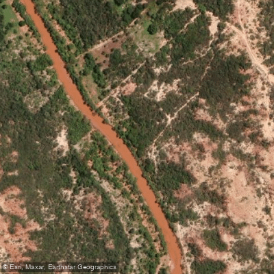
Rio Uruçuí-Vermelho
- Boat Ramps
- 0
- Access Points
- 0
- Campsites
- 0
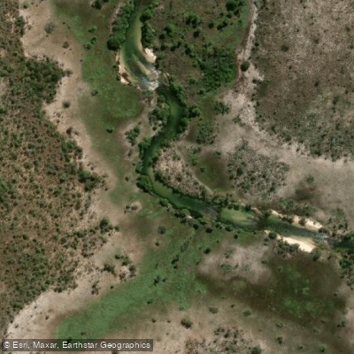
The Rio Uruçuí-Vermelho is a right-bank tributary of the Rio Parnaíba in the state of Piauí, northeastern Brazil. It originates at the Serra do Penitente in southern Piauí and flows approximately 400 kilometers through the Cerrado biome before joining the Rio Parnaíba near the town of Uruçuí. The river passes through the municipalities of Bom Jesus, Currais, and Santa Filomena along its course.
Unlike the intermittent rivers typical of the sertão, the Uruçuí-Vermelho maintains a reasonably stable flow throughout the year, fed by veredas, wetland areas, and small chapadas characteristic of the Cerrado. This perennial character makes the river accessible across seasons, though water levels are lower during the dry season when flow concentrates in deeper pools. The river carries a notable sediment load — it is responsible for the reddish, turbid coloration of the Rio Parnaíba downstream of their confluence.
The upper reaches of the river fall within the APA dos Altos Cursos dos Rios Gurguéia e Uruçuí-Vermelho, a state-administered environmental protection area of approximately 119,829 hectares established in 2017, covering municipalities including Barreiras do Piauí, Gilbués, and São Gonçalo do Gurguéia. Paddlers planning trips in this zone should consult the Secretaria do Meio Ambiente e Recursos Hídricos do Piauí (SEMARH-PI) regarding any applicable regulations.
Bom Jesus is the most practical base for accessing the river, offering lodging and services. Road access from Teresina runs via BR-343 south to Floriano and then BR-135 south to Bom Jesus, a distance of roughly 640 kilometers. Final access roads to the riverbank are typically unpaved, and a high-clearance vehicle is advisable. Wildlife in the surrounding Cerrado includes species typical of that biome, and the river supports fish including surubim, curimatã, piau, traíra, and mandi.
Water access, boat ramps & amenities
Learn how to get on Rio Uruçuí-Vermelho. Uncover great paddling access points, boat ramps, and all the facilities you need for an unforgettable day on the water. Some locations shown may border or include private property. Always check property boundaries and applicable regulations before visiting. PaddleWays's Public & Private Land layer can help you plan your access with confidence.
Paddle smarter with real-time insights
Whether you're en route and conditions shift or you're looking for the best spot based on current flows, we enable you to make informed decisions on the fly.







Maranhão licenses and regulations
No licenses or regulations available for Maranhão.
Find Places to Paddle

Over 400,000 Places to Paddle
Every user gets free access to launch points, boat ramps, and public property parcels.


Water and weather conditions (10 day forecast)
See the best times to paddle Rio Uruçuí-Vermelho and check the forecast before you go.
No forecast data available.
Explore Maranhão waters
Top paddling waters
No waters available right now.
Popular Cities
Loading popular cities...
Explore near Rio Uruçuí-Vermelho
More in Maranhão

Smarter Paddling Starts in the App.
Paddleways gives you everything you need to plan smarter, paddle better, and own every trip from first launch to takeout.