Rio Iriri
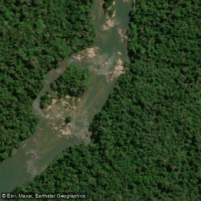
Rio Iriri
- Boat Ramps
- 0
- Access Points
- 0
- Campsites
- 0
The Rio Iriri is a major tributary of the Xingu River, flowing for approximately 1,300 kilometers through the state of Pará in Brazil. It is a large river characterized by its remote location within the Amazon basin, offering a pristine and isolated paddling environment. The river's course is situated in a region of unique biodiversity, with the surrounding rainforest providing a dramatic and untouched aesthetic. A significant portion of the river flows through protected territory in partnership with the indigenous Kayapó people, which contributes to its exceptionally clean water quality and undisturbed natural state. This protection also implies that access and activities on the river are likely subject to specific regulations and permissions, and independent paddling without proper authorization may not be permitted. The primary point of access mentioned in relation to the Rio Iriri is the area around Kendjam, which serves as a base for guided expeditions. The overall character of the experience is one of total exclusivity and remoteness, appealing to those seeking a wilderness adventure far from developed areas. Wildlife is a prominent feature, with the river known for a variety of fish species, indicating a healthy aquatic ecosystem. There is no information available regarding public access points for launching or taking out craft, standard paddling routes, seasonal water temperatures, water flow patterns, or the presence of hazards like rapids. The lack of details on facilities, amenities, and explicit regulations for independent paddlers suggests that recreational use is primarily managed through licensed outfitters operating in the protected area.
Water access, boat ramps & amenities
Learn how to get on Rio Iriri. Uncover great paddling access points, boat ramps, and all the facilities you need for an unforgettable day on the water. Some locations shown may border or include private property. Always check property boundaries and applicable regulations before visiting. PaddleWays's Public & Private Land layer can help you plan your access with confidence.
Paddle smarter with real-time insights
Whether you're en route and conditions shift or you're looking for the best spot based on current flows, we enable you to make informed decisions on the fly.







Mato Grosso licenses and regulations
No licenses or regulations available for Mato Grosso.
Find Places to Paddle

Over 400,000 Places to Paddle
Every user gets free access to launch points, boat ramps, and public property parcels.


Water and weather conditions (10 day forecast)
See the best times to paddle Rio Iriri and check the forecast before you go.
São Raimundo
All Flow Stations


Explore Mato Grosso waters
Top paddling waters
No waters available right now.
Popular Cities
Loading popular cities...
Explore near Rio Iriri
More in Mato Grosso

Smarter Paddling Starts in the App.
Paddleways gives you everything you need to plan smarter, paddle better, and own every trip from first launch to takeout.