Rio São Lourenço
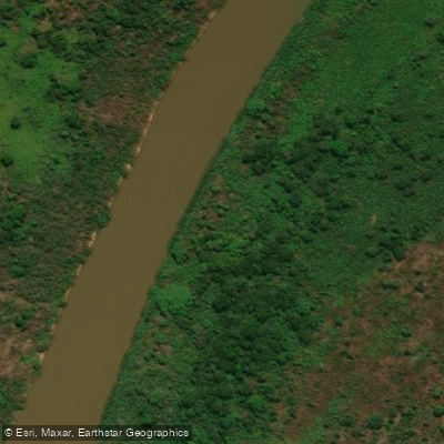
Rio São Lourenço
- Boat Ramps
- 0
- Access Points
- 0
- Campsites
- 1
The Rio São Lourenço is a tributary of the Paraguay River, flowing approximately 480 kilometers in a generally southwest direction through the Pantanal, the vast alluvial plain that spans portions of Brazil, Bolivia, and Paraguay. Its entire basin lies within Mato Grosso state. The river rises in the south of Mato Grosso — in its upper reaches it is sometimes referred to as the Pingara River, and its headwaters are fed by the Vermelho River (also known as the Poguba River), which originates near Rondonópolis and transitions into the São Lourenço around the municipality of Barão de Melgaço.
The river flows west into the Encontro das Águas State Park, where it is joined by the Cuiabá River. It then continues southwest across the park, defining the western border of the park's southern section. The Piquiri River joins the São Lourenço at the park's southwest boundary, after which the river continues southwest along the border between Mato Grosso and Mato Grosso do Sul before emptying into the Paraguay River, approximately 130 kilometers north of Corumbá. The São Lourenço is navigable for small craft and has historically served as a trade and travel route.
The river is designated as part of a Ramsar wetland site, reflecting its ecological significance within the Pantanal. The town of Porto Jofre, in Mato Grosso, sits near the river and is a recognized access point for the region. A bridge project spanning approximately 300 meters is planned near Porto Jofre to connect Mato Grosso and Mato Grosso do Sul, which may alter access logistics in the future. The surrounding Pantanal environment offers wildlife observation opportunities, and the area draws both national and international visitors interested in ecotourism and sport fishing.
Water access, boat ramps & amenities
Learn how to get on Rio São Lourenço. Uncover great paddling access points, boat ramps, and all the facilities you need for an unforgettable day on the water. Some locations shown may border or include private property. Always check property boundaries and applicable regulations before visiting. PaddleWays's Public & Private Land layer can help you plan your access with confidence.
Paddle smarter with real-time insights
Whether you're en route and conditions shift or you're looking for the best spot based on current flows, we enable you to make informed decisions on the fly.







Mato Grosso licenses and regulations
No licenses or regulations available for Mato Grosso.
Find Places to Paddle

Over 400,000 Places to Paddle
Every user gets free access to launch points, boat ramps, and public property parcels.


Water and weather conditions (10 day forecast)
See the best times to paddle Rio São Lourenço and check the forecast before you go.
Campo Verde
All Flow Stations
Explore Mato Grosso waters
Top paddling waters
No waters available right now.
Popular Cities
Loading popular cities...
Explore near Rio São Lourenço
Access points
More in Mato Grosso

Smarter Paddling Starts in the App.
Paddleways gives you everything you need to plan smarter, paddle better, and own every trip from first launch to takeout.