Represa Rosana
Represa Rosana
- Boat Ramps
- 0
- Access Points
- 0
- Campsites
- 0
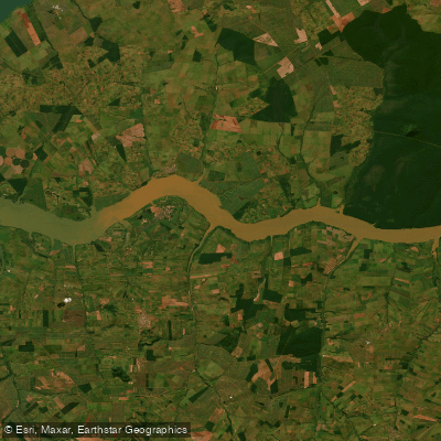
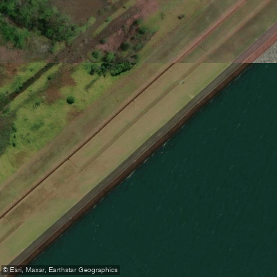
Represa Rosana is a large reservoir formed by a dam on the Rio Paranapanema, situated on the border between the state of Paraná and the state of São Paulo. The dam itself lies between the municipality of Diamante do Norte in Paraná and the municipality of Rosana in São Paulo. Inaugurated in 1987, the reservoir covers approximately 217 square kilometers, making it a substantial body of water with considerable open stretches. The dam structure extends 2,308 meters in length, and the maximum water surface elevation is 258 meters above sea level.
The reservoir was created to power a hydroelectric facility equipped with four Kaplan-type turbines, generating a total installed capacity of 353 MW. As with most large hydroelectric reservoirs in Brazil, paddlers should be aware that dam operations can influence water levels and flow conditions, and the area immediately around the dam structure itself warrants caution due to operational infrastructure and potential currents near the intake zones.
Given its size of 217 km², the reservoir offers extensive open water, which means paddlers can encounter significant wind fetch and wave development under adverse weather conditions. The broad surface area typical of reservoirs of this scale in the Paranapanema valley means that exposed crossings require careful planning and attention to weather patterns.
Paddlers planning a trip to Represa Rosana should contact local authorities in Diamante do Norte or the relevant dam operator for up-to-date access permissions, safety restrictions, and any designated launch sites before visiting.
Water access, boat ramps & amenities
Learn how to get on Represa Rosana. Uncover great paddling access points, boat ramps, and all the facilities you need for an unforgettable day on the water. Some locations shown may border or include private property. Always check property boundaries and applicable regulations before visiting. PaddleWays's Public & Private Land layer can help you plan your access with confidence.
Paddle smarter with real-time insights
Whether you're en route and conditions shift or you're looking for the best spot based on current flows, we enable you to make informed decisions on the fly.







Paraná licenses and regulations
No licenses or regulations available for Paraná.
Find Places to Paddle

Over 400,000 Places to Paddle
Every user gets free access to launch points, boat ramps, and public property parcels.


Water and weather conditions (10 day forecast)
See the best times to paddle Represa Rosana and check the forecast before you go.
Uhe Rosana Reservatório 2 Montante
All Flow Stations
Paddling near Represa Rosana
Explore Paraná waters
Top paddling waters
No waters available right now.
Popular Cities
Loading popular cities...
Explore near Represa Rosana
Nearby waters
More in Paraná

Smarter Paddling Starts in the App.
Paddleways gives you everything you need to plan smarter, paddle better, and own every trip from first launch to takeout.