Goose Bay
- Saltwater
- Bay
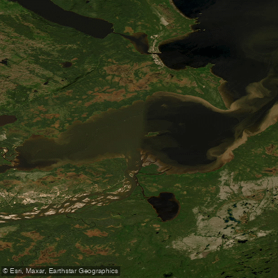
Goose Bay
- Saltwater
- Bay
- Sq. miles
- 78
- Boat Ramps
- 0
- Access Points
- 0
- Campsites
- 0
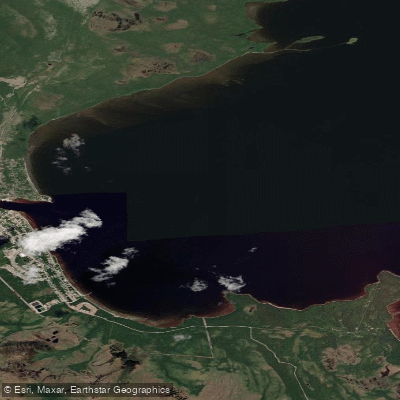
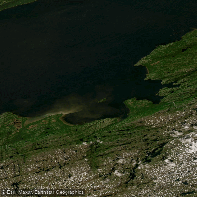
Goose Bay is a coastal saltwater bay located in Happy Valley-Goose Bay, Newfoundland and Labrador. It is the southern tip of the much larger Lake Melville, a massive tidal body of water that is an extension of Hamilton Inlet and stretches 140 kilometers long and 32 kilometers wide. This connection to the Labrador Sea creates a dynamic tidal environment, making an understanding of tidal patterns essential for safe paddling. The bay and lake are characterized by expansive, open waters with a long shoreline featuring numerous inlets, offering extensive opportunities for exploration. The town of Happy Valley-Goose Bay sits directly on the bay, providing access points. A public boat launch is available via the Labrador Hunting & Fishing Association on the North West River Road. The overall character of paddling here is one of exploration across a vast, scenic landscape, with the area holding historical significance for local Indigenous communities, including the Inuit of Nunatsiavut and the Innu Nation, who have relied on these waters for generations. The region has a strong paddling tradition, evidenced by the historical Labrador Canoe Regatta, which featured intense six-person canoe races. For paddlers, the primary considerations are the significant wind exposure and fetch across such a large, open body of water, the essential need to plan for tidal currents, and potential for boat traffic given the popularity of the area for motorboating and sailing. The water is crystal-clear. The best season for paddling is summer, from June to September.
Water access, boat ramps & amenities
Learn how to get on Goose Bay. Uncover great paddling access points, boat ramps, and all the facilities you need for an unforgettable day on the water. Some locations shown may border or include private property. Always check property boundaries and applicable regulations before visiting. PaddleWays's Public & Private Land layer can help you plan your access with confidence.
Paddle smarter with real-time insights
Whether you're en route and conditions shift or you're looking for the best spot based on current flows, we enable you to make informed decisions on the fly.







Nl licenses and regulations
No licenses or regulations available for Nl.
Find Places to Paddle

Over 400,000 Places to Paddle
Every user gets free access to launch points, boat ramps, and public property parcels.


Tides, wind & water conditions (10 day forecast)
On open water, wind and tide matter as much as the weather. See the best times to paddle Goose Bay and check the marine forecast before you launch.
Loading tide predictions…
Explore Nl waters
Top paddling waters
No waters available right now.
Popular Cities
Loading popular cities...
Explore near Goose Bay

Smarter Paddling Starts in the App.
Paddleways gives you everything you need to plan smarter, paddle better, and own every trip from first launch to takeout.