Thlewiaza River
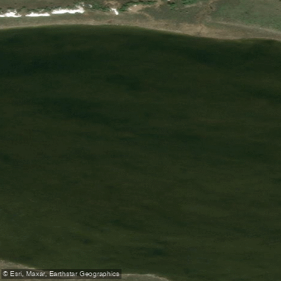
Thlewiaza River
- Boat Ramps
- 0
- Access Points
- 0
- Campsites
- 0
The Thlewiaza River flows approximately 275 kilometres through Nunavut after exiting the northern end of Nueltin Lake, passing through Edehon Lake and Ranger Seal Lake before emptying into Hudson Bay south of Arviat. Its drainage basin covers roughly 64,400 square kilometres. The river's Chipewyan name, Łuazedes, means "little fish river," a reference to the abundant grayling in its waters. The Inuit know it simply as "the big river," historically using it to travel inland for arctic fox trapping and caribou hunting.
Harbour seals have been documented as far upstream as Edehon Lake, with sightings also reported at Nueltin Lake. There are no permanent settlements anywhere along the route.
The typical multi-week journey begins at the south end of Nueltin Lake in Manitoba, accessed by road to Thompson and then by chartered floatplane — commonly a single Otter turbo — approximately 350 kilometres north. The full route from Nueltin Lake to Hudson Bay covers around 400 kilometres and typically takes 19 to 22 paddling days. Egress from the river mouth requires arranging a chartered motorboat to Arviat, roughly 80 kilometres to the north, followed by commercial aviation via Rankin Inlet. Boat pickup services operate between the mouth and both Churchill and Arviat.
The river carries a substantial volume of whitewater throughout. The most technically demanding section is Portage Rapids, described as a mile-long stretch of serious whitewater. Between Kasmere and Nueltin lakes, paddlers have historically portaged at a Class IV rapid and at Nahilin Falls at the entrance to Nueltin Lake. A significant series of rapids also occurs between Graves and Sucker Lakes, with three distinct pitches. Water levels vary considerably by season; at high water the river runs fast and some rocky rapids become more passable, while lower water can make certain sections more difficult to navigate. Hap Wilson's guidebook has been cited as a useful and generally accurate reference for the route.
Air temperatures during the paddling season range roughly from 8°C to 25°C. Biting insects — blackflies and mosquitoes — are a persistent presence. Floating lake ice can remain on Nueltin Lake into the paddling season, and late-season ice has been observed along shorelines. Fish are described as abundant. The river corridor is extremely remote, with no facilities of any kind, and the route demands strong wilderness paddling skills and thorough self-sufficiency.
Water access, boat ramps & amenities
Learn how to get on Thlewiaza River. Uncover great paddling access points, boat ramps, and all the facilities you need for an unforgettable day on the water. Some locations shown may border or include private property. Always check property boundaries and applicable regulations before visiting. PaddleWays's Public & Private Land layer can help you plan your access with confidence.
Paddle smarter with real-time insights
Whether you're en route and conditions shift or you're looking for the best spot based on current flows, we enable you to make informed decisions on the fly.








Find Places to Paddle

Over 400,000 Places to Paddle
Every user gets free access to launch points, boat ramps, and public property parcels.


Water and weather conditions (10 day forecast)
See the best times to paddle Thlewiaza River and check the forecast before you go.
No forecast data available.
Explore Nu waters
Top paddling waters
No waters available right now.
Popular Cities
Loading popular cities...
Explore near Thlewiaza River
Nearby waters
More in Nu

Smarter Paddling Starts in the App.
Paddleways gives you everything you need to plan smarter, paddle better, and own every trip from first launch to takeout.