Curated by PaddleWays
RouteClass I–III
- Distance
- 10.6 mi
- Paddle time
- ~2.5 hrs
- Best for
- Kayak, raft
- Put-in → take-out
- Camas Creek Access → Moonstone Boat Ramp
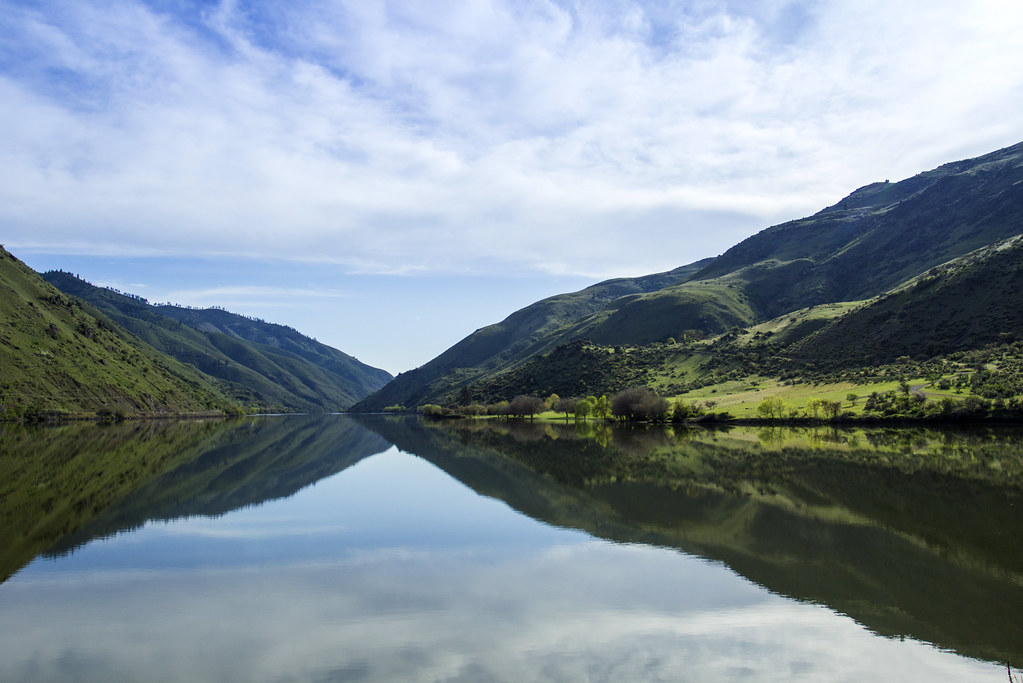
Camas Creek flows through the high desert and mountainous terrain of south-central Idaho, originating in the Pioneer Mountains near the Blaine-Camas county boundary. The creek flows generally westward through Camas County before entering Elmore County, where it eventually drains into the South Fork of the Boise River at Anderson Ranch Reservoir. This watershed occupies a critical position in the broader Boise River drainage system.
The creek's headwaters begin at elevations exceeding 9,000 feet in the rugged country around Dollarhide Summit, where snowmelt feeds the initial flows. As Camas Creek descends through Camas County, it traverses sagebrush steppe and scattered conifer forests, creating a ribbon of riparian habitat in an otherwise arid landscape. The drainage encompasses significant wilderness character, with portions flowing through roadless areas managed by the Sawtooth National Forest.
Water flows are highly seasonal, with peak runoff typically occurring during spring snowmelt from late April through June. By mid-summer, flows diminish considerably, and sections may become intermittent during drought years. This variability makes Camas Creek primarily a springtime destination for any water-based recreation, though flows can be unpredictable and are heavily dependent on snowpack conditions in the Pioneer Mountains.
The Camas Creek watershed serves as important habitat for mule deer, elk, and pronghorn antelope, which utilize the drainage for both summer range and migration corridors. The riparian corridor provides critical nesting habitat for songbirds and supports populations of native cutthroat trout in its upper reaches, though fish populations are limited by seasonal flow reductions and natural barriers.
Access to Camas Creek is primarily via Forest Service roads branching from Highway 20, which runs through southern Camas County. The town of Fairfield in Camas County serves as the nearest population center to much of the drainage. In Elmore County, access becomes more limited as the creek approaches Anderson Ranch Reservoir, with Forest Service Road 227 (Dollarhide Summit-Carrie Creek Road) providing the primary route into the upper watershed.
The Camas Creek area holds historical significance as traditional hunting grounds and later as part of the livestock grazing economy that shaped central Idaho's development. The watershed's name derives from the camas lily, a plant historically harvested by Native American tribes throughout the region, though the plant is more commonly associated with wetter meadow environments than this particular drainage's typical habitat.
Recreationists should note that this is remote country with limited services, variable road conditions, and significant wildlife management considerations, including seasonal motorized vehicle restrictions in portions of the drainage.
Curated routes
Hand-picked by the PaddleWays team, with put-ins, take-outs, paddle times and the hazards along the way.
RouteClass I–III
Hazards
No hazards are marked on Camas Creek yet. That is not the same as none being there: if you find one, report it for the next paddler.
From the community
Nobody has shared a trip on Camas Creek yet. Paddle it, then tell the next paddler how it went.
See exactly where the public can get on and off the river. Launch points and boat ramps are paired with PaddleWays' public land data so you know where you can legally land.
Public shoreline
22%of the river's shoreline is public
Most of the riverbank is private. Launch, land and camp only at public access points.
Flows, weather and a route-by-route verdict, so you know which stretch of the Camas Creek is worth paddling today.
Live flows, marked hazards and fresh trip reports from paddlers who were just on the water, all in one place.





Every user gets free access to launch points, boat ramps, and public property parcels.
When using any type of watercraft to access a body of water, it is important to follow all federal, state, and local rules and regulations. These rules and regulations include boat permitting and licensing, invasive species inspections and stamps, life jacket and PFD rules, motor size and horsepower restrictions, noise limitations, restrictions on personal watercraft, and many more. Visit the web link below for the most current rules and regulations for this body of water.
When using any type of watercraft to access a body of water, it is important to follow all federal, state, and local rules and regulations. These rules and regulations include boat permitting and licensing, invasive species inspections and stamps, life jacket and PFD rules, motor size and horsepower restrictions, noise limitations, restrictions on personal watercraft, and many more. Visit the web link below for the most current rules and regulations for this body of water.
"To fish in Idaho any person 14 years of age or older must have a valid fishing license. Anglers younger than 14 do not need a license, but there is a small difference between resident and nonresident youth. -A resident child under 14 has their own separate fishing limit. -A nonresident child under 14 must be with someone who has a valid fishing license and their fish are in included in the license holders fishing limit. However, a nonresident child may purchase their own license and have their own limit. Special fishing permits are need for some activities for both residents and nonresidents: -Fishing for salmon and steelhead -Fishing with two poles."
This river has a variety of species and regulations, including potential floating and/or watercraft restrictions. Because this river is specially managed for species, seasons, angling methods, and watercraft, it is strongly encouraged you check all federal, state, and local regulations before fishing. Visit any of the links below, inquire locally, or contact a local fly shop to learn current regulations and restrictions.
Navigable streams are recognized as public transportation corridors, thus members of the public have the right to use the corridor, provided they enter and exit the corridor at a public right of way and remain within the corridor. Many navigable streams flow through private property, thus it is important that anglers know their rights and responsibilities when fishing in navigable waters that flow through private property.
Loading popular cities...
PaddleWays gives you everything you need to plan smarter, paddle better, and own every trip from first launch to takeout.