Cottonwood Creek
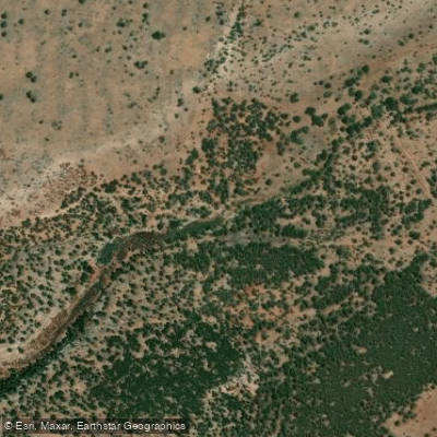
Cottonwood Creek
- Boat Ramps
- 0
- Access Points
- 1
- Campsites
- 0
Cottonwood Creek flows through the high desert terrain of McKinley and Cibola Counties in west-central New Mexico, serving as a tributary to Bluewater Creek. This watercourse drains portions of the landscape near the Ramah Navajo Indian Reservation in Cibola County, contributing to the regional watershed system in an area characterized by semi-arid conditions and variable precipitation patterns.
The creek's flow regime is highly intermittent, typical of New Mexico's western waterways, with water levels dependent on seasonal snowmelt, monsoonal summer rains, and localized precipitation events. During much of the year, sections of the streambed may be dry or contain only isolated pools, making this creek unsuitable for recreational paddling. The ephemeral nature of flow means that even during wet periods, sustained paddling opportunities are extremely limited or nonexistent.
The surrounding landscape reflects the ecological transition zone between the Colorado Plateau and the Basin and Range Province. Elevations in this region generally range from approximately 6,500 to 7,500 feet, supporting vegetation communities adapted to alkaline soils and limited moisture availability. Pinyon-juniper woodlands dominate higher elevations, while riparian corridors—when water is present—may support cottonwood trees, willows, and various shrub species that provide critical habitat for wildlife.
The area falls within traditional lands of indigenous peoples, including Navajo and Pueblo communities, with the Ramah Navajo Chapter maintaining significant presence in the watershed. Historical land use has included livestock grazing, and the creek's drainage has been shaped by both natural processes and human activity over centuries.
Access to Cottonwood Creek is limited by the remote nature of the terrain, private land holdings, and proximity to reservation lands where access may be restricted without proper permissions. The nearest population centers include Grants in Cibola County and communities along Interstate 40, though specific public access points to the creek itself are not well-documented for recreational purposes.
Given the intermittent flow characteristics, Cottonwood Creek does not support conventional paddling activities. Those interested in the waterway would find it more suitable for hiking, wildlife observation during wet periods, or geological study rather than boating. Any visitation should respect private property boundaries, tribal lands, and the fragile desert riparian ecosystem. Water availability should never be assumed, and the creek's role is primarily ecological and hydrological rather than recreational in the traditional paddling sense.
Water access, boat ramps & amenities
Learn how to get on Cottonwood Creek. Uncover great paddling access points, boat ramps, and all the facilities you need for an unforgettable day on the water. Some locations shown may border or include private property. Always check property boundaries and applicable regulations before visiting. PaddleWays's Public & Private Land layer can help you plan your access with confidence.
Paddle smarter with real-time insights
Whether you're en route and conditions shift or you're looking for the best spot based on current flows, we enable you to make informed decisions on the fly.








Find Places to Paddle

Over 400,000 Places to Paddle
Every user gets free access to launch points, boat ramps, and public property parcels.


Water and weather conditions (10 day forecast)
See the best times to paddle Cottonwood Creek and check the forecast before you go.
No forecast data available.
Explore New Mexico waters
Top paddling waters
Popular Cities
Loading popular cities...
Explore near Cottonwood Creek
Nearby waters
More in New Mexico

Smarter Paddling Starts in the App.
Paddleways gives you everything you need to plan smarter, paddle better, and own every trip from first launch to takeout.