Paddling near Medora, ND
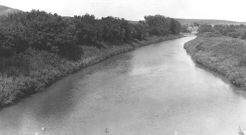
Medora sits in the North Dakota Badlands at the edge of Theodore Roosevelt National Park's South Unit, and the Little Missouri River is the defining paddling water here. The river runs north through dramatic butte-and-cottonwood canyon country, and the classic multi-day canoe route covers roughly 107.5 miles from Medora to the Long X Bridge near the park's North Unit. A popular day trip puts in at Sully Creek State Park just south of town and takes out at Cottonwood Campground — about four to six hours on the water. Water levels are highly variable and dictate everything; some years the river runs too low to float at all.
Paddle smarter with real-time insights
Whether you're en route and conditions shift or you're looking for the best spot based on current flows, we enable you to make informed decisions on the fly.







North Dakota licenses and regulations
Explore Medora
Top paddling waters
Loading top waters...
Popular Cities
Loading popular cities...

Smarter Paddling Starts in the App.
Paddleways gives you everything you need to plan smarter, paddle better, and own every trip from first launch to takeout.