Caledon
Caledon
- Boat Ramps
- 0
- Access Points
- 0
- Campsites
- 0
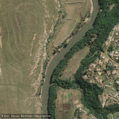
The Caledon River below Welbedacht Dam is a surprisingly challenging stretch for K1 paddlers. It is a large river when carrying water, featuring several significant rapids that warrant serious attention. The primary constraint on paddling this section is water availability: the Welbedacht Dam is a small, deep impoundment that silts up regularly, and releases only occur following substantial rainfall. As a result, the river is too low to paddle most of the time, and the section is typically run when a race is organised and event coordinators arrange a controlled release from the dam.
The put-in is below Welbedacht Dam. From there, approximately 5km of flat water leads to one of the larger rapids, which features a notable drop and several waves that make it demanding in a K1. About 3km further downstream, a rapid with a 1-metre drop sits directly in front of an iron bridge; this should be run on the far left. Another 3km on, a rapid called "Yster se hek" is located on a right-hand riverbend. Shortly after, the river splits around an island, with both channels offering interesting but manageable rapids. Roughly 2km of flat water then leads to a weir, which can be shot on the far right, though paddlers should be cautious of rocks at the base.
The following 8km is largely flat and uneventful. A relatively large rapid marks the end of this section, with a tight turn at the bottom. A series of smaller rapids follows over the next kilometre, concluding with a slightly larger drop that is best run toward the left. The final kilometres to the racing take-out are flat. The take-out is located on the farm Klein Holstein, identifiable by a round stone-built pumphouse. From this point downstream to the N6, the river is entirely flat.
Given the dependence on dam releases for adequate water levels, paddlers planning a trip on this section should coordinate with race organisers or monitor release schedules rather than relying on natural flow conditions alone.
Water access, boat ramps & amenities
Learn how to get on Caledon. Uncover great paddling access points, boat ramps, and all the facilities you need for an unforgettable day on the water. Some locations shown may border or include private property. Always check property boundaries and applicable regulations before visiting. PaddleWays's Public & Private Land layer can help you plan your access with confidence.
Paddle smarter with real-time insights
Whether you're en route and conditions shift or you're looking for the best spot based on current flows, we enable you to make informed decisions on the fly.








Find Places to Paddle

Over 400,000 Places to Paddle
Every user gets free access to launch points, boat ramps, and public property parcels.


Water and weather conditions (10 day forecast)
See the best times to paddle Caledon and check the forecast before you go.
D2R004
All Flow Stations
Explore Free State waters
Top paddling waters
No waters available right now.
Popular Cities
Loading popular cities...
Explore near Caledon
Access points
More in Free State

Smarter Paddling Starts in the App.
Paddleways gives you everything you need to plan smarter, paddle better, and own every trip from first launch to takeout.