Flag Boshielo
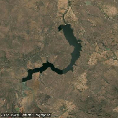
Flag Boshielo
- Boat Ramps
- 0
- Access Points
- 0
- Campsites
- 0
Flag Boshielo Dam is a large reservoir on the Olifants River in Limpopo Province, South Africa, situated near the town of Marble Hall. Completed in 1987 and subsequently raised by 5 metres in 2006, the dam wall stands 36 metres high and 1,225 metres long, impounding a surface area of approximately 1,288 hectares with a total capacity of around 185 million cubic metres. The raising of the wall effectively doubled the surface area and pushed water up to 800 metres into the surrounding bushveld, creating an extensive network of submerged trees, rocky reefs, and flooded tributary arms that define the character of the water body.
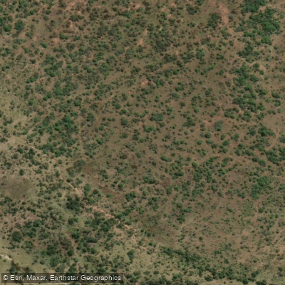
The dam sits within a bushveld landscape adjacent to a nature reserve, lending it a distinctly wild character. The surrounding terrain is rocky and vegetated, with the flooded bush creating considerable underwater structure throughout much of the reservoir. Paddlers should be aware that this structure — submerged trees and rocky reefs — is extensive and presents significant navigation hazards, particularly in tributary arms and shallower sections. Visibility in the water is limited, with Secchi depth measurements recorded between 0.62 and 0.85 metres, indicating consistently moderate turbidity.
A critical safety consideration is the presence of Nile crocodiles. The dam reportedly holds one of the largest breeding colonies of Nile crocodiles on the African continent, with aerial surveys counting over 160 breeding-size individuals in the mid-section of the dam alone, some reaching 5 to 6 metres in length. This must be treated as a serious hazard for any paddler on the water.
Water temperatures follow a seasonal pattern typical of a monomictic system. Surface temperatures range from around 21°C in June to approximately 28°C in February, with thermal stratification developing from October through February. Turnover occurs between April and June, when near-isothermal conditions prevail at around 16°C throughout the water column.
The Matlala Aloe Park, located on the eastern banks, offers camping, boating, and fishing facilities. Access to the area is available via the N11 national road, which connects Limpopo, Mpumalanga, and KwaZulu-Natal. The dam is managed by the Department of Water and Sanitation, and boating activity on the reservoir is permitted, though any aids to navigation require authorisation from the relevant authorities.
Water access, boat ramps & amenities
Learn how to get on Flag Boshielo. Uncover great paddling access points, boat ramps, and all the facilities you need for an unforgettable day on the water. Some locations shown may border or include private property. Always check property boundaries and applicable regulations before visiting. PaddleWays's Public & Private Land layer can help you plan your access with confidence.
Paddle smarter with real-time insights
Whether you're en route and conditions shift or you're looking for the best spot based on current flows, we enable you to make informed decisions on the fly.








Find Places to Paddle

Over 400,000 Places to Paddle
Every user gets free access to launch points, boat ramps, and public property parcels.


Water and weather conditions (10 day forecast)
See the best times to paddle Flag Boshielo and check the forecast before you go.
No forecast data available.
Explore Limpopo waters
Top paddling waters
No waters available right now.
Popular Cities
Loading popular cities...
Explore near Flag Boshielo
More in Limpopo

Smarter Paddling Starts in the App.
Paddleways gives you everything you need to plan smarter, paddle better, and own every trip from first launch to takeout.