Tzaneen Dam
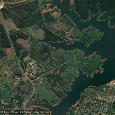
Tzaneen Dam
- Boat Ramps
- 0
- Access Points
- 0
- Campsites
- 0
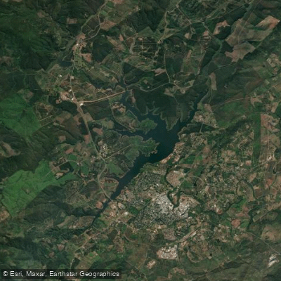
Tzaneen Dam, also known as Fanie Botha Dam, is an earth-fill dam impounding the Great Letaba River (fed also by the Ramadiepa River) in Limpopo Province, approximately 8 km from the town of Tzaneen. Built in 1976 primarily for agricultural irrigation and municipal water supply, the dam covers a surface area of roughly 1,163.6 hectares with a capacity of approximately 157 million cubic meters. Its shape features a main body that branches into three distinct arms or "legs," offering varied paddling terrain including bays, channels, points, and submerged structures such as old roads, buildings, and trees from before the dam was filled.
Canoeing is an explicitly permitted recreational activity on the dam, managed by the Department of Water Affairs (DWS). There are two controlled access points: one at the Lions Club, which holds a lease agreement with the Greater Tzaneen Local Municipality, and one at the Tzaneen Dam Nature Reserve (TDNR). Access to the water through any other point is considered illegal unless a formal agreement has been arranged with DWS. Paddlers should be aware that all shoreline and surface water access must be through these authorised entry points only.
A critical safety consideration is the confirmed presence of hippopotamuses and crocodiles in the dam. These animals are cited as the reason swimming is explicitly prohibited, and they represent a serious hazard for paddlers as well. Full-contact water activities are not permitted. Paddlers should exercise extreme caution, particularly in shallow bays, along vegetated shorelines, and in the arms of the dam where wildlife may be present.
The submerged structure throughout the dam — including old trees, buildings, and road networks — creates numerous snags. Anglers on the dam routinely use boats to navigate these hazards, and paddlers should be aware that underwater obstructions are widespread, particularly in the bays and along drop-offs near the dam wall. The three arms of the dam offer distinct paddling areas, with bays near the bridge on the left arm, brushy drop-offs near the dam wall to the right, and channels running 10–15 feet deep in places. Despite being a man-made reservoir, the dam blends into its surrounding landscape in a way that gives it a natural lake character.
Water access, boat ramps & amenities
Learn how to get on Tzaneen Dam. Uncover great paddling access points, boat ramps, and all the facilities you need for an unforgettable day on the water. Some locations shown may border or include private property. Always check property boundaries and applicable regulations before visiting. PaddleWays's Public & Private Land layer can help you plan your access with confidence.
Paddle smarter with real-time insights
Whether you're en route and conditions shift or you're looking for the best spot based on current flows, we enable you to make informed decisions on the fly.








Find Places to Paddle

Over 400,000 Places to Paddle
Every user gets free access to launch points, boat ramps, and public property parcels.


Water and weather conditions (10 day forecast)
See the best times to paddle Tzaneen Dam and check the forecast before you go.
No forecast data available.
Explore Limpopo waters
Top paddling waters
No waters available right now.
Popular Cities
Loading popular cities...
Explore near Tzaneen Dam
More in Limpopo

Smarter Paddling Starts in the App.
Paddleways gives you everything you need to plan smarter, paddle better, and own every trip from first launch to takeout.