Disaneng Dam
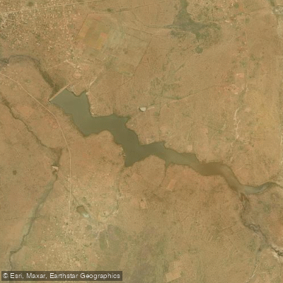
Disaneng Dam
- Boat Ramps
- 0
- Access Points
- 0
- Campsites
- 0
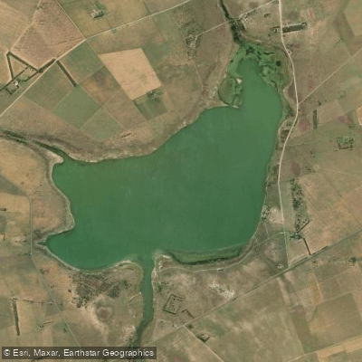
Disaneng Dam is an earthfill dam on the Molopo River located in the Ratlou Local Municipality, near the border of the Mahikeng Local Municipality and close to Mmabatho in North West, South Africa. Completed in 1980 and operated by the Department of Water Affairs and Forestry, the reservoir covers approximately 435.9 hectares with a total storage capacity of 17,400,000 cubic metres. The dam wall stands 17 metres high and extends 780 metres in length, creating a substantial open-water impoundment suited to boat-based activity.
There is a boat launch slip on the Disaneng side of the dam, adjacent to a private resort that offers chalets and a camping area with ablution facilities. This side of the reservoir provides a maintained entry point for those launching motorised or paddle craft. The opposite shore, known as the Kabe side, is more undeveloped bush terrain with no formal facilities, offering a more remote character for those willing to access it independently.
The dam attracts migratory birds, particularly around the dam wall, which may be of interest to paddlers moving through that area. The surrounding landscape is characteristic of the North West province, with open bushveld framing the water.
Security and facility conditions on the Disaneng side have varied considerably over time, with some accounts describing well-maintained amenities and others noting the absence of formal oversight. Paddlers planning an overnight stay should verify current conditions at the resort before arrival. The Kabe side has no formal facilities and is described as a true bush environment.
The dam's primary designated purpose is irrigation, and it supports populations of carp, king carp, tilapia, catfish, and bass. Anglers use motorised boats on the water, so paddlers should be aware of boat traffic, particularly on weekends or during fishing competitions. No paddling-specific restrictions are documented, but the presence of powered craft is a practical consideration for route planning.
Water access, boat ramps & amenities
Learn how to get on Disaneng Dam. Uncover great paddling access points, boat ramps, and all the facilities you need for an unforgettable day on the water. Some locations shown may border or include private property. Always check property boundaries and applicable regulations before visiting. PaddleWays's Public & Private Land layer can help you plan your access with confidence.
Paddle smarter with real-time insights
Whether you're en route and conditions shift or you're looking for the best spot based on current flows, we enable you to make informed decisions on the fly.








Find Places to Paddle

Over 400,000 Places to Paddle
Every user gets free access to launch points, boat ramps, and public property parcels.


Water and weather conditions (10 day forecast)
See the best times to paddle Disaneng Dam and check the forecast before you go.
No forecast data available.
Explore North West waters
Top paddling waters
No waters available right now.
Popular Cities
Loading popular cities...
Explore near Disaneng Dam
More in North West

Smarter Paddling Starts in the App.
Paddleways gives you everything you need to plan smarter, paddle better, and own every trip from first launch to takeout.