Laguna de los Porongos
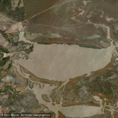
Laguna de los Porongos
- Boat Ramps
- 0
- Access Points
- 0
- Campsites
- 0
Laguna de los Porongos lies approximately 380 kilometers southeast of the city of Santiago del Estero, within Departamento Rivadavia, near the borders of Departamentos Quebracho and Mitre. It sits close to the provincial boundary with Santa Fe, and the nearest settlement is Colonia Mac Kinlay, roughly 60 kilometers from Selva, the departmental capital. The laguna has been declared a protected natural area by provincial authorities.
The water body is part of the Bañados del Río Dulce wetland system, a vast lowland environment where open water, reed beds, and flooded grasslands merge across the flat landscape. The surface is generally calm and reflective, with juncos (rushes) lining the shallows and wide skies overhead. Approaching and entering the water requires navigating thick, deep mud along the margins, which can be physically demanding and should be factored into any access plan.
Wildlife is a primary draw. The laguna supports notable populations of pink flamingos, teros, gallaretas, and suris (rheas), making it a recognized destination along ornithological routes. Migratory birds also use the wetland, adding seasonal variety to sightings. Fishing for tarariras and doradillos is practiced in the area.
The combination of remote location, muddy access, and wetland terrain means paddlers should be self-sufficient. No facilities or amenities for paddlers exist at the site. Road access to the area is poor and unreliable, which has practical implications for reaching the put-in with boats and gear.
Water access, boat ramps & amenities
Learn how to get on Laguna de los Porongos. Uncover great paddling access points, boat ramps, and all the facilities you need for an unforgettable day on the water. Some locations shown may border or include private property. Always check property boundaries and applicable regulations before visiting. PaddleWays's Public & Private Land layer can help you plan your access with confidence.
Paddle smarter with real-time insights
Whether you're en route and conditions shift or you're looking for the best spot based on current flows, we enable you to make informed decisions on the fly.







Córdoba licenses and regulations

Find Places to Paddle

Over 400,000 Places to Paddle
Every user gets free access to launch points, boat ramps, and public property parcels.


Water and weather conditions (10 day forecast)
See the best times to paddle Laguna de los Porongos and check the forecast before you go.
No forecast data available.
Paddling near Laguna de los Porongos
Explore Córdoba waters
Top paddling waters
No waters available right now.
Popular Cities
Loading popular cities...
Explore near Laguna de los Porongos
More in Córdoba

Smarter Paddling Starts in the App.
Paddleways gives you everything you need to plan smarter, paddle better, and own every trip from first launch to takeout.