Embalse El Carrizal
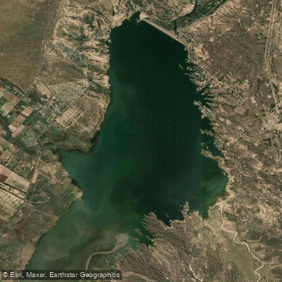
Embalse El Carrizal
- Boat Ramps
- 2
- Access Points
- 0
- Campsites
- 4
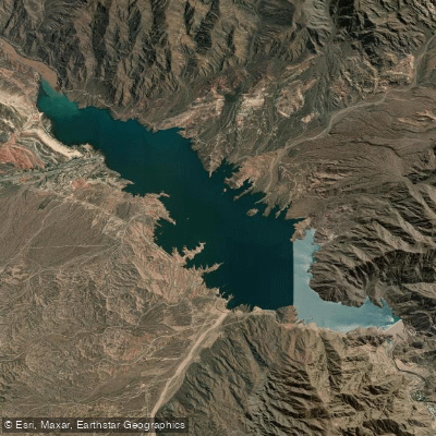
Embalse El Carrizal is a large reservoir located approximately 60 km southeast of the city of Mendoza, formed by the El Carrizal Dam on the Tunuyán River. The dam, an earth and rock-fill embankment structure 46 meters high and over 2,100 meters long, was completed in 1971 primarily for irrigation and hydroelectric purposes. The reservoir stretches roughly 15 km in length and 4–5 km in width, covering an area of approximately 34.8 square kilometers, with a maximum water elevation of 785.5 meters above sea level and a maximum storage volume of 462 million cubic meters. The Tunuyán River, which feeds the reservoir, originates from glacial sources in the Andes.
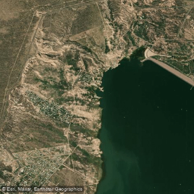
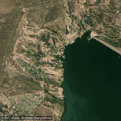
Access to the reservoir is via the intersection of RN 40 and RP 16, passing through the communities of El Carrizal de Arriba, Carrizal del Medio, and El Carrizal de Abajo. The eastern shore is reached by crossing the dam wall and hosts 12 nautical clubs, each with boat ramps and launch facilities; at least two boat ramps are documented on the reservoir. The eastern shore falls within the department of Rivadavia, while the western shore belongs to Luján de Cuyo.
Paddling is explicitly permitted on the reservoir. Canoes, kayaks, and rafts are among the watercraft in use, alongside motorized vessels, water skis, and windsurfers. A YouTube video documents a 28-km kayak traverse through the mouth of the dam at extreme water levels, indicating that paddlers do explore the full extent of the reservoir and its inlet areas. Given the coexistence of motorized craft including jet skis and motorboats, paddlers should be aware of heavy recreational boat traffic, particularly on weekends and during the summer holiday season.
The dominant fish species is pejerrey Gran Paraná, and fishing from rafts is a common activity on the reservoir. The surrounding landscape combines scrubland with trees and irrigated oasis zones. The eastern shore in particular is well developed for recreation, with camping areas, tourist complexes, and diving schools also present. The reservoir's waters are described as blue in appearance. No specific paddling restrictions or seasonal closures for paddling have been identified, though official Mendoza fishing regulations include a veda (closed season) for El Carrizal that paddling anglers should consult before visiting.
Water access, boat ramps & amenities
Learn how to get on Embalse El Carrizal. Uncover great paddling access points, boat ramps, and all the facilities you need for an unforgettable day on the water. Some locations shown may border or include private property. Always check property boundaries and applicable regulations before visiting. PaddleWays's Public & Private Land layer can help you plan your access with confidence.
Paddle smarter with real-time insights
Whether you're en route and conditions shift or you're looking for the best spot based on current flows, we enable you to make informed decisions on the fly.







Mendoza licenses and regulations

Find Places to Paddle

Over 400,000 Places to Paddle
Every user gets free access to launch points, boat ramps, and public property parcels.


Water and weather conditions (10 day forecast)
See the best times to paddle Embalse El Carrizal and check the forecast before you go.
No forecast data available.
Explore Mendoza waters
Top paddling waters
No waters available right now.
Popular Cities
Loading popular cities...
Explore near Embalse El Carrizal
Access points
More in Mendoza

Smarter Paddling Starts in the App.
Paddleways gives you everything you need to plan smarter, paddle better, and own every trip from first launch to takeout.