Arroyo Monje
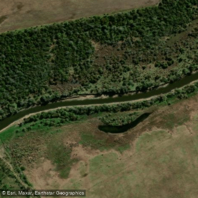
Arroyo Monje
- Boat Ramps
- 0
- Access Points
- 0
- Campsites
- 1
Arroyo Monje flows through the south-central portion of Santa Fe province, draining a watershed of approximately 7,132 km² across the departments of San Martín, San Jerónimo, Belgrano, and Iriondo before emptying into the río Coronda at Balneario Monje. The stream crosses the Pampean plain, a gently rolling landscape characterized by flattened ridges alternating with low-lying depressions that hold lagoons and seasonally flooded areas. The basin has been significantly modified by roads, rural tracks, and drainage canals, all of which influence how water moves through the system.
One documented kayak route runs from a beach near the mouth upstream to a waterfall known as the Cascada del Arroyo Monje, a one-way distance of 4.5 km. Paddled at a relaxed pace with stops for photos and rest, the upstream leg takes approximately 1 hour and 20 minutes. The return downstream moves noticeably faster. Along this stretch, high banks (barrancas altas) expose distinct horizontal layers of soil, providing visual interest throughout the paddle. At the waterfall itself, there is a firm surface above the waterline where paddlers can disembark and rest. When water levels are normal, fish can be observed jumping at the cascade as they attempt to move upstream. The waterfall's appearance changes with water level: at lower stages it is less pronounced but more fully exposed.
At the mouth of the arroyo, Balneario Monje is a small settlement with cabins, camping areas, and rental houses, making it a practical base for paddling trips. The waters near the confluence with the río Coronda are calm and are used for water sports and fishing. Paddlers planning an afternoon trip to the waterfall should start early enough to allow for rest stops along the way.
Water access, boat ramps & amenities
Learn how to get on Arroyo Monje. Uncover great paddling access points, boat ramps, and all the facilities you need for an unforgettable day on the water. Some locations shown may border or include private property. Always check property boundaries and applicable regulations before visiting. PaddleWays's Public & Private Land layer can help you plan your access with confidence.
Paddle smarter with real-time insights
Whether you're en route and conditions shift or you're looking for the best spot based on current flows, we enable you to make informed decisions on the fly.







Santa Fe licenses and regulations

Find Places to Paddle

Over 400,000 Places to Paddle
Every user gets free access to launch points, boat ramps, and public property parcels.


Water and weather conditions (10 day forecast)
See the best times to paddle Arroyo Monje and check the forecast before you go.
Aº El Monje - Autopista A01

Explore Santa Fe waters
Top paddling waters
No waters available right now.
Popular Cities
Loading popular cities...
Explore near Arroyo Monje
Access points
Nearby waters
More in Santa Fe

Smarter Paddling Starts in the App.
Paddleways gives you everything you need to plan smarter, paddle better, and own every trip from first launch to takeout.