Paddling in Annan River (Yuku Baja-Muliku) National Park
- National Park
- Lakes
- 0
- Rivers
- 6
- Access
- 0
- Boat Ramps
- 0
- Shops
- 0
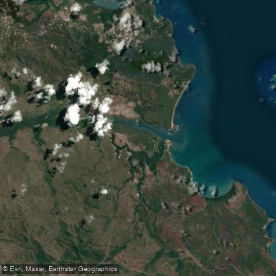
The Annan River runs through the southern edge of Cape York Peninsula in Tropical North Queensland, roughly 10 kilometres south of Cooktown.
The park it anchors — jointly managed by Queensland Parks and Wildlife Service and the Yuku Baja-Muliku Land Trust — protects a wide sweep of country where the river meets tidal flats, mangroves, melaleuca swamps, and coastal dunes before reaching the sea.
This is low-gradient, estuarine country, not whitewater country. The Annan River itself is the central water here. It forms the northern boundary of the park's 8,830 hectares and moves through riparian rainforest and wetland before opening into tidal reaches.
Canoeing is specifically noted as an activity the river supports.
The character of the paddling is shaped by tidal influence and the flat, seasonally flooded terrain — expect slow water, shifting banks, and the kind of visibility that demands attention to crocodile presence.
Estuarine crocodiles (*Crocodylus porosus*) are confirmed residents of the park, and that fact should anchor every decision about where and how you get on and off the water. The wet season drives the hydrology here.
Seasonal flooding is part of how this landscape functions, and it affects access and water levels in ways that can close or transform the river corridor.
The dry season — broadly the cooler months — is when access is more reliable and conditions more predictable. The Mulligan Highway provides the main road corridor into the area, and public transport does not reach the park; a vehicle is necessary.
Because this is jointly managed country with deep cultural significance to the Yuku Baja-Muliku people, paddlers should check current access conditions and any visitor rules directly with Queensland Parks before launching.
The park holds sites of cultural significance, and respectful use of the water is part of what paddling here requires. The Annan is not a river you run for the rapids.
You paddle it for the country it moves through — tidal forest, open wetland, the weight of a landscape that has been known and cared for for thousands of years.
Top waters to paddle near Annan River Yuku Baja Muliku National Park
Water and weather conditions (10 day forecast)
See the best times to paddle Annan River (Yuku Baja-Muliku) National Park and check the forecast before you go.
No forecast data available.
Paddle smarter with real-time insights
Whether you're en route and conditions shift or you're looking for the best spot based on current flows, we enable you to make informed decisions on the fly.







Paddling near Annan River (Yuku Baja-Muliku) National Park
Loading...
Gateway towns
Where to base yourself for paddling in Annan River (Yuku Baja-Muliku) National Park.
- CooktownQueensland
The nearest town to the park, just north of the entrance, with lodging, caravan parks, and visitor services for the area.
- RossvilleQueensland
Small community on the Mulligan Highway at the southern approach to the park, with eco-lodge and camping options nearby.
Explore Annan River (Yuku Baja-Muliku) National Park
Top paddling waters
Popular Cities
Loading popular cities...

Smarter Paddling Starts in the App.
Paddleways gives you everything you need to plan smarter, paddle better, and own every trip from first launch to takeout.