Sleaford Mere
Sleaford Mere
- Boat Ramps
- 0
- Access Points
- 0
- Campsites
- 0
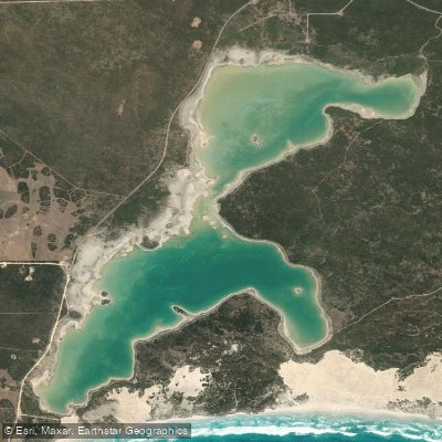
Sleaford Mere, also known by its indigenous name Kuyabidni, is a permanent saline lake situated on the Jussieu Peninsula at the southeastern tip of Eyre Peninsula in South Australia, approximately 15 kilometres southwest of Port Lincoln. The lake measures roughly 4.8 to 6.4 kilometres in length and about 1.6 kilometres in width, with a surface area of 7.07 square kilometres. It is notably shallow, averaging only 0.61 to 0.91 metres in depth, and sits at an elevation of 20 metres. The water is hypersaline, with conductivity ranging from 23.0 to 64.0 millisiemens per centimetre — saltier than seawater — which gives it a distinctive buoyancy and chemical character that paddlers should be aware of when rinsing gear afterward.
The lake has been part of the Sleaford Mere Conservation Park since 1969 and was listed as a nationally important wetland in 2005. Swimming and kayaking on the lake are explicitly permitted within the conservation park. There are no dedicated visitor facilities at the lake itself, though camping and basic toilet facilities are available at Sleaford Bay campsite within the adjacent Lincoln National Park. Food, fuel, and other services are available in Port Lincoln.
Access to the lake is via unsealed tracks within the national park, reached from Proper Bay Road. A four-wheel drive vehicle is strongly recommended and considered essential after rain, as tracks can become impassable in wet conditions. Entry to the lake is directly from the shoreline.
Water temperature follows a seasonal range of approximately 14 to 21 degrees Celsius, tracking ambient air temperature. The lake's inland, protected position means there is no swell or tidal current, and even strong coastal winds produce only modest surface chop across the shallow water, making conditions generally stable for paddling.
The lake is listed in the Directory of Important Wetlands in Australia and provides habitat for a range of waterbirds, including the nationally critically endangered curlew sandpiper, the threatened fairy tern, and the hooded plover. Of particular scientific interest, Sleaford Mere is one of only a small number of places in Australia where stromatolites are found. The surrounding vegetation includes coastal white mallee woodland, dryland tea-tree shrubland, and sedgelands, with permanent freshwater soaks at the northern end supporting frogs and rare plant species.
Water access, boat ramps & amenities
Learn how to get on Sleaford Mere. Uncover great paddling access points, boat ramps, and all the facilities you need for an unforgettable day on the water. Some locations shown may border or include private property. Always check property boundaries and applicable regulations before visiting. PaddleWays's Public & Private Land layer can help you plan your access with confidence.
Paddle smarter with real-time insights
Whether you're en route and conditions shift or you're looking for the best spot based on current flows, we enable you to make informed decisions on the fly.







South Australia licenses and regulations

Find Places to Paddle

Over 400,000 Places to Paddle
Every user gets free access to launch points, boat ramps, and public property parcels.


Water and weather conditions (10 day forecast)
See the best times to paddle Sleaford Mere and check the forecast before you go.
No forecast data available.
Paddling near Sleaford Mere
Minniribbie Creek
Port Douglas/Coffin Bay
Tod Reservoir
Salt Creek
Shelly Beach
Salt Creek
Woodcutters Beach
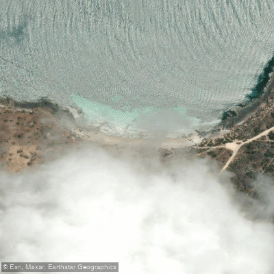
Donington Beach
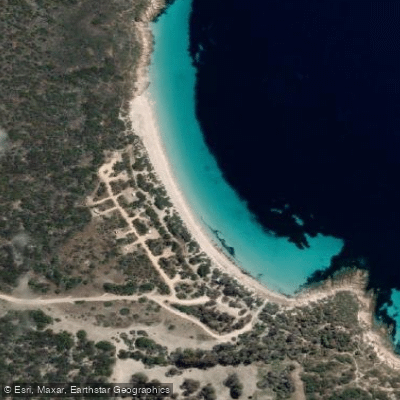
September Beach
Explore South Australia waters
Top paddling waters
No waters available right now.
Popular Cities
Loading popular cities...
Explore near Sleaford Mere

Smarter Paddling Starts in the App.
Paddleways gives you everything you need to plan smarter, paddle better, and own every trip from first launch to takeout.