Rio Juruá
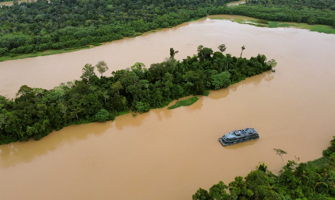
Rio Juruá
- Boat Ramps
- 0
- Access Points
- 0
- Campsites
- 0
The Rio Juruá is one of the most sinuous rivers in the Amazon basin, originating in the highlands of east-central Peru at an elevation of roughly 450 meters and flowing northward through Acre state before entering Amazonas state, where it meanders eastward and east-northeastward to discharge into the Solimões River near Tamaniquá. Its total length is approximately 3,283 km, yet the river descends very gradually, giving it an exceptionally low gradient that produces the extreme curvature, sluggishness, and broad floodplain character it shares with the nearby Rio Purus.
The river is a white-water river in the Amazonian classification sense — meaning it carries sediment-rich, nutrient-laden water — and forms extensive várzea (seasonally flooded lowland forest) along its margins. These floodplain mosaics are subject to pronounced seasonal inundation. The basin encompasses roughly 217,000 km², with about 28,000 km² of wetlands, and thousands of oxbow lakes dot the floodplain. The surrounding landscape is low, half-flooded forest country with sparsely inhabited banks; many tributaries were not mapped until satellite surveys in the late 1970s.
The Rio Juruá is navigable for more than 950 km above its confluence with the Amazon, and regular boat traffic operates along its length, including larger vessels between Cruzeiro do Sul and Marechal Thaumaturgo in the upper section. Local river travel relies heavily on canoes — both paddled and motorized — as well as medium-size motorboats. The rainy season runs roughly December through April, during which water levels rise substantially and the transportation character of the river shifts dramatically; the dry season occupies the other half of the year. Paddlers should account for this strong seasonal variation when planning any trip.
The basin contains significant protected areas, including the Serra do Divisor National Park in the upper Juruá and multiple extractive reserves (RESEX) in the middle and lower sections, which may carry specific access or use regulations. The river supports rich aquatic life, and local communities rely on hook-and-line fishing, cast nets, and gillnets. The broader region is considered the most protected major sub-basin in the Amazon, with recognized indigenous territories throughout.
Water access, boat ramps & amenities
Learn how to get on Rio Juruá. Uncover great paddling access points, boat ramps, and all the facilities you need for an unforgettable day on the water. Some locations shown may border or include private property. Always check property boundaries and applicable regulations before visiting. PaddleWays's Public & Private Land layer can help you plan your access with confidence.
Paddle smarter with real-time insights
Whether you're en route and conditions shift or you're looking for the best spot based on current flows, we enable you to make informed decisions on the fly.







Acre licenses and regulations
No licenses or regulations available for Acre.
Find Places to Paddle

Over 400,000 Places to Paddle
Every user gets free access to launch points, boat ramps, and public property parcels.


Water and weather conditions (10 day forecast)
See the best times to paddle Rio Juruá and check the forecast before you go.
Foz Do Breu
All Flow Stations
Explore Acre waters
Top paddling waters
No waters available right now.
Popular Cities
Loading popular cities...
Explore near Rio Juruá
Nearby waters
More in Acre

Smarter Paddling Starts in the App.
Paddleways gives you everything you need to plan smarter, paddle better, and own every trip from first launch to takeout.