Rio Cajari
Rio Cajari
- Boat Ramps
- 0
- Access Points
- 0
- Campsites
- 0
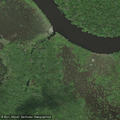
The Rio Cajari flows through the state of Amapá in northern Brazil, primarily within the protected area known as the Rio Cajari Extractive Reserve. This reserve encompasses a landscape of dense Amazonian rainforest and cerrado fields, creating a remote and natural setting for paddling. The waterway is central to the reserve's history, which is tied to the rubber extraction cycle that began in the mid-20th century. The overall character of a paddling trip here is one of immersion in a protected, biodiverse forest environment, with the river serving as a vital transportation and resource-gathering corridor for local extractivist communities.
Access to the river and the reserve is facilitated by Federal Highway BR-156, an unpaved road that crosses the northwestern portion of the protected area. This highway provides the primary access points for reaching the river. The best time to visit for paddling and travel is during the drier season, when paths and waterways are more navigable. Within the reserve, notable sights include the traditional Brazil nut groves, which are managed by local families who may spend weeks in the forest during the harvest. Paddlers should be aware that this is a working extractive reserve, and they will be sharing the environment with residents engaged in sustainable harvesting activities. The river's course through the reserve offers opportunities for multi-day trips, with the potential to observe the rich flora and fauna of the Amazon rainforest and cerrado transition zones.
Water access, boat ramps & amenities
Learn how to get on Rio Cajari. Uncover great paddling access points, boat ramps, and all the facilities you need for an unforgettable day on the water. Some locations shown may border or include private property. Always check property boundaries and applicable regulations before visiting. PaddleWays's Public & Private Land layer can help you plan your access with confidence.
Paddle smarter with real-time insights
Whether you're en route and conditions shift or you're looking for the best spot based on current flows, we enable you to make informed decisions on the fly.







Amapá licenses and regulations
No licenses or regulations available for Amapá.
Find Places to Paddle

Over 400,000 Places to Paddle
Every user gets free access to launch points, boat ramps, and public property parcels.


Water and weather conditions (10 day forecast)
See the best times to paddle Rio Cajari and check the forecast before you go.
Foz Do Rio Cajari
All Flow Stations
Explore Amapá waters
Top paddling waters
No waters available right now.
Popular Cities
Loading popular cities...
Explore near Rio Cajari
Nearby waters
More in Amapá

Smarter Paddling Starts in the App.
Paddleways gives you everything you need to plan smarter, paddle better, and own every trip from first launch to takeout.