Rio Poti
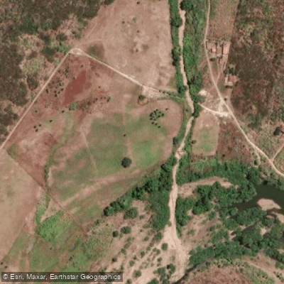
Rio Poti
- Boat Ramps
- 0
- Access Points
- 0
- Campsites
- 0
The Rio Poti flows through the states of Piauí and Ceará in northeastern Brazil, offering two distinct paddling environments: an urban stretch near Teresina and a dramatic canyon section near Buriti dos Montes on the Piauí-Ceará border.
In Teresina, organized kayak tours depart from Raul Lopes Avenue and run approximately two hours on the river. A notable stop along this urban stretch is the fossil forest of Teresina, a paleontological site containing logs from the Permian period dating back more than 270 million years. Tours include equipment and basic safety instruction.
The Cânion do Rio Poti near Buriti dos Montes presents a more remote and visually striking experience. The canyon is characterized by distinctive rock formations and dark, clear water. Boat tours through the canyon are available, with private guided options recommended. Access to the embarkation point is via a paved and marked road.
Seasonal timing is a critical planning consideration for the canyon section. During the rainy season, the river can rise by up to 3 meters, rendering navigation through the canyon impossible. Tours and paddling in this section are therefore limited to the dry season. Paddlers planning a canyon trip should confirm current seasonal conditions before visiting.
The Poti River basin holds significant archaeological and historical interest. Thousands of rock carvings and rock paintings in shelters throughout the canyon region indicate that this corridor served as a migratory route for early inhabitants of the Americas, connecting the plains of Piauí and Maranhão with the semi-arid regions of Ceará, Pernambuco, and Bahia. The canyon area supports additional adventure activities including abseiling and climbing, which may be relevant for multi-day trip planning.
Water access, boat ramps & amenities
Learn how to get on Rio Poti. Uncover great paddling access points, boat ramps, and all the facilities you need for an unforgettable day on the water. Some locations shown may border or include private property. Always check property boundaries and applicable regulations before visiting. PaddleWays's Public & Private Land layer can help you plan your access with confidence.
Paddle smarter with real-time insights
Whether you're en route and conditions shift or you're looking for the best spot based on current flows, we enable you to make informed decisions on the fly.







Ceará licenses and regulations
No licenses or regulations available for Ceará.
Find Places to Paddle

Over 400,000 Places to Paddle
Every user gets free access to launch points, boat ramps, and public property parcels.


Water and weather conditions (10 day forecast)
See the best times to paddle Rio Poti and check the forecast before you go.
Crateús
All Flow Stations
Explore Ceará waters
Top paddling waters
No waters available right now.
Popular Cities
Loading popular cities...
Explore near Rio Poti
More in Ceará

Smarter Paddling Starts in the App.
Paddleways gives you everything you need to plan smarter, paddle better, and own every trip from first launch to takeout.