Rio Parnaíba
Rio Parnaíba
- Boat Ramps
- 0
- Access Points
- 1
- Campsites
- 1
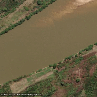
The Rio Parnaíba runs approximately 1,400 km, forming the border between Maranhão and Piauí before emptying into the Atlantic Ocean through a vast delta. The river is generally navigable along its course, with the exception of the section divided by the Boa Esperança Hydroelectric Power Plant dam in the middle reaches.
The most compelling paddling destination along this river is the Delta do Parnaíba, also known as the Delta das Américas — the only open-sea delta in the Americas and the third largest in the world, covering roughly 2,700 km² across more than 70 islands. The delta splits into five main channels: Igaraçu, Canárias, Caju, Melancieiras, and Tutoia. This labyrinth of waterways weaves through mangroves, coastal dunes, and tropical forest, creating a complex and visually striking environment. The largest island, Ilha das Canárias, supports a fishing community that relies on traditional methods using canoes and nets.
Navigation in the delta requires care. The network of igarapés and shifting sandbanks presents real orientation challenges, and getting lost or grounded is a genuine risk — a hazard documented as far back as 1571 when Portuguese explorer Nicolau de Resende became stranded in the region. Paddlers unfamiliar with the area are strongly advised to travel with a local guide or pilot who knows the channels.
Wildlife in the delta is notable and includes monkeys, iguanas, scarlet ibis (locally called guaras), and large populations of red and purple crabs in the mangrove mud. Porto dos Tatus serves as a central hub for delta excursions, and the Morro do Meio dunes and Pontal Beach are accessible highlights from there. Organized boat tours depart from the city of Parnaíba on the Piauí side, offering a reference point for logistics when approaching the delta from that direction.
Water access, boat ramps & amenities
Learn how to get on Rio Parnaíba. Uncover great paddling access points, boat ramps, and all the facilities you need for an unforgettable day on the water. Some locations shown may border or include private property. Always check property boundaries and applicable regulations before visiting. PaddleWays's Public & Private Land layer can help you plan your access with confidence.
Paddle smarter with real-time insights
Whether you're en route and conditions shift or you're looking for the best spot based on current flows, we enable you to make informed decisions on the fly.







Maranhão licenses and regulations
No licenses or regulations available for Maranhão.
Find Places to Paddle

Over 400,000 Places to Paddle
Every user gets free access to launch points, boat ramps, and public property parcels.


Water and weather conditions (10 day forecast)
See the best times to paddle Rio Parnaíba and check the forecast before you go.
Porto
All Flow Stations
Paddling near Rio Parnaíba
Explore Maranhão waters
Top paddling waters
No waters available right now.
Popular Cities
Loading popular cities...
Explore near Rio Parnaíba
Access points
Nearby waters
More in Maranhão

Smarter Paddling Starts in the App.
Paddleways gives you everything you need to plan smarter, paddle better, and own every trip from first launch to takeout.