Rio Verde ou Rio Verdão
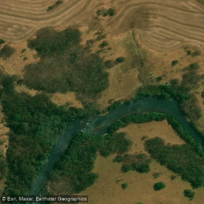
Rio Verde ou Rio Verdão
- Boat Ramps
- 0
- Access Points
- 0
- Campsites
- 0
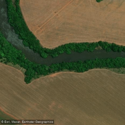
The Rio Verdão, also known as Rio Verde, is a river flowing through the southern part of the state of Goiás in central Brazil. It is a tributary of the larger Rio dos Bois. The river passes by or through the municipalities of Rio Verde, Santa Helena de Goiás, and Maurilândia, indicating potential access points for paddlers in these general areas. A specific trailhead or access point is documented near the town of Turvelândia, Goiás, where a diving trail follows the river's course. The river's Portuguese name translates to "Big Green River," suggesting a waterway with a notable greenish hue, likely due to its natural setting and vegetation. The region is characterized by the Brazilian Cerrado biome, which implies a landscape of tropical savanna with gallery forests potentially lining the riverbanks. The river is used for diving and exploration, indicating clear water suitable for such activities at certain times. There is no indication of specific paddling restrictions, major hazards like rapids or dams, or developed facilities for boaters along its banks. The overall character appears to be that of a regional river supporting local communities and recreational activities within the Goiás interior.
Water access, boat ramps & amenities
Learn how to get on Rio Verde ou Rio Verdão. Uncover great paddling access points, boat ramps, and all the facilities you need for an unforgettable day on the water. Some locations shown may border or include private property. Always check property boundaries and applicable regulations before visiting. PaddleWays's Public & Private Land layer can help you plan your access with confidence.
Paddle smarter with real-time insights
Whether you're en route and conditions shift or you're looking for the best spot based on current flows, we enable you to make informed decisions on the fly.







Goiás licenses and regulations
No licenses or regulations available for Goiás.
Find Places to Paddle

Over 400,000 Places to Paddle
Every user gets free access to launch points, boat ramps, and public property parcels.


Water and weather conditions (10 day forecast)
See the best times to paddle Rio Verde ou Rio Verdão and check the forecast before you go.
Montividiu
All Flow Stations
Explore Goiás waters
Top paddling waters
No waters available right now.
Popular Cities
Loading popular cities...
Explore near Rio Verde ou Rio Verdão
More in Goiás

Smarter Paddling Starts in the App.
Paddleways gives you everything you need to plan smarter, paddle better, and own every trip from first launch to takeout.