Rio Taquari
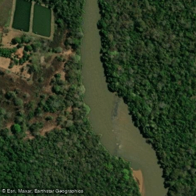
Rio Taquari
- Boat Ramps
- 0
- Access Points
- 0
- Campsites
- 0
The Rio Taquari originates in the state of Mato Grosso and flows southward through a winding, fast-moving course before entering Mato Grosso do Sul, where it eventually meets the Rio Coxim near the town of Coxim. The river stretches approximately 753 kilometers in total length and is a left tributary of the Paraguay River, with its mouth located at approximately 19°14′32″S, 57°13′29″W. The headwaters are protected within the 30,619-hectare Nascentes do Rio Taquari State Park, established in 1999 near Alcinópolis, in a transition zone between the cerrado and pantanal biomes.
The river is characterized by a highly sinuous channel with swift currents and tight bends, particularly in its upper reaches. As it descends through Mato Grosso do Sul, it passes through the eastern edges of the Pantanal wetlands. The town of Coxim serves as a practical base for river access, and boat travel along the Taquari toward floating hotels and fishing camps in the Caronal area is an established activity. The river supports navigation by sailboats and motorized vessels, indicating sufficient depth and width for paddling craft along at least portions of its lower course.
The Rio Taquari is considered the most degraded river in the Pantanal basin of Mato Grosso do Sul, a designation that reflects significant environmental pressures on water quality. Paddlers should factor this into trip planning. The river supports a diverse fish population including piranhas, pacú, piau, and various catfish species — the presence of piranhas is worth noting for anyone considering swimming during a paddling trip.
Near Coxim, Campo Falls on the Rio Taquari is a notable landmark and a popular spot for swimming, despite the presence of piranhas. The nearby Palmeiras Falls on the Rio Coxim is another point of interest. Between November and January, both falls are sites of the piracema migration, during which large numbers of fish leap upstream to spawn — a striking natural spectacle that coincides with the wet season. Paddlers planning trips during this period should be aware that water levels and currents will be higher. Brazil requires recreational vessels to be registered with the Navy's DPC and operators to hold a Vessel Inscription Title (TIE/TIEM), valid for five years, before operating on Brazilian waters.
Water access, boat ramps & amenities
Learn how to get on Rio Taquari. Uncover great paddling access points, boat ramps, and all the facilities you need for an unforgettable day on the water. Some locations shown may border or include private property. Always check property boundaries and applicable regulations before visiting. PaddleWays's Public & Private Land layer can help you plan your access with confidence.
Paddle smarter with real-time insights
Whether you're en route and conditions shift or you're looking for the best spot based on current flows, we enable you to make informed decisions on the fly.







Mato Grosso licenses and regulations
No licenses or regulations available for Mato Grosso.
Find Places to Paddle

Over 400,000 Places to Paddle
Every user gets free access to launch points, boat ramps, and public property parcels.


Water and weather conditions (10 day forecast)
See the best times to paddle Rio Taquari and check the forecast before you go.
Pch Lajari Montante
All Flow Stations
Explore Mato Grosso waters
Top paddling waters
No waters available right now.
Popular Cities
Loading popular cities...
Explore near Rio Taquari
More in Mato Grosso

Smarter Paddling Starts in the App.
Paddleways gives you everything you need to plan smarter, paddle better, and own every trip from first launch to takeout.