Rio das Antas
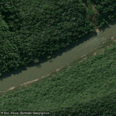
Rio das Antas
- Boat Ramps
- 0
- Access Points
- 0
- Campsites
- 1
The Rio das Antas flows approximately 390 kilometers through Rio Grande do Sul, originating in the municipality of São José dos Ausentes within the Aparados da Serra National Park at an elevation of around 1,200 meters. It travels westward across the state until it joins the Rio Carreiro near Bento Gonçalves and São Valentim do Sul, at which point it takes on the name Rio Taquari.
The river's character varies considerably along its length. The upper and middle sections are turbulent with an absence of floodplains, giving the river a more dynamic, fast-moving nature. This stands in contrast to the lower Taquari, which below the city of Muçum becomes generally navigable with broad várzeas. The turbulent regime of the Rio das Antas proper makes it more suited to paddlers comfortable with moving water conditions.
The river passes through the Serra Gaúcha region, with paddling activity in the area around Caxias do Sul, including near a landmark known as Ponte dos Korff. The surrounding landscape reflects the elevated plateau terrain of the Planalto dos Campos Gerais in the upper reaches, transitioning as the river descends toward the lowlands.
Water access, boat ramps & amenities
Learn how to get on Rio das Antas. Uncover great paddling access points, boat ramps, and all the facilities you need for an unforgettable day on the water. Some locations shown may border or include private property. Always check property boundaries and applicable regulations before visiting. PaddleWays's Public & Private Land layer can help you plan your access with confidence.
Paddle smarter with real-time insights
Whether you're en route and conditions shift or you're looking for the best spot based on current flows, we enable you to make informed decisions on the fly.







Rio Grande Do Sul licenses and regulations
No licenses or regulations available for Rio Grande Do Sul.
Find Places to Paddle

Over 400,000 Places to Paddle
Every user gets free access to launch points, boat ramps, and public property parcels.


Water and weather conditions (10 day forecast)
See the best times to paddle Rio das Antas and check the forecast before you go.
Rio Das Antas (S. José Dos Ausentes)
All Flow Stations
Explore Rio Grande Do Sul waters
Top paddling waters
No waters available right now.
Popular Cities
Loading popular cities...
Explore near Rio das Antas
Access points
Nearby waters
More in Rio Grande Do Sul

Smarter Paddling Starts in the App.
Paddleways gives you everything you need to plan smarter, paddle better, and own every trip from first launch to takeout.