Rio Piratini ou Rio Piratinim
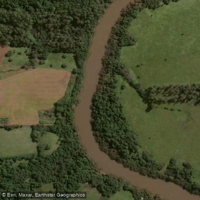
Rio Piratini ou Rio Piratinim
- Boat Ramps
- 0
- Access Points
- 0
- Campsites
- 0
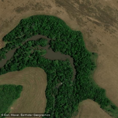
The Rio Piratini flows through the state of Rio Grande do Sul in southern Brazil. The name derives from the Tupi words meaning "rebellious fish" (pirá = fish; tiní = angry or rebellious). The river has historical significance as a former boundary marker: until 1864, much of its course formed the accepted frontier between Uruguay and Brazil.
The river passes through the noroeste gaúcho region near the municipalities of Três Passos and Tenente Portela, and in its southern reaches separates the municipalities of Pedro Osório and Cerrito before emptying into the Canal de São Gonçalo. A railway bridge connecting Pedro Osório and Cerrito is notable for having survived a destructive flood in 1992 that damaged surrounding structures.
Water depth along the river averages between 1 and 4 meters, with a recorded maximum of around 8 meters. The river features clear water and preserved riparian vegetation along its banks. Flow monitoring stations are located at several points along the course, including Passo do Dias, Passo do Sarmento, Passo Santa Maria, and Ponte do Piratinim, as well as near Santo Antônio das Missões and São Miguel das Missões.
The cooler months of autumn and winter (approximately April through August), when water temperatures tend to fall in the range of 16–22°C, offer favorable paddling conditions. Rural roads providing access to the river can become difficult after heavy rainfall, and four-wheel-drive vehicles are advisable when using unpaved routes. The nearest larger service center in the northwest section is Três Passos, located approximately 450 km from Porto Alegre via BR-386 and BR-468. Access by boat is possible via ramps at Três Passos.
Under Brazilian federal law, inland waters are classified as public assets, though access points may border private land, and paddlers should verify property boundaries before launching.
Water access, boat ramps & amenities
Learn how to get on Rio Piratini ou Rio Piratinim. Uncover great paddling access points, boat ramps, and all the facilities you need for an unforgettable day on the water. Some locations shown may border or include private property. Always check property boundaries and applicable regulations before visiting. PaddleWays's Public & Private Land layer can help you plan your access with confidence.
Paddle smarter with real-time insights
Whether you're en route and conditions shift or you're looking for the best spot based on current flows, we enable you to make informed decisions on the fly.







Rio Grande Do Sul licenses and regulations
No licenses or regulations available for Rio Grande Do Sul.
Find Places to Paddle

Over 400,000 Places to Paddle
Every user gets free access to launch points, boat ramps, and public property parcels.


Water and weather conditions (10 day forecast)
See the best times to paddle Rio Piratini ou Rio Piratinim and check the forecast before you go.
Passo Do Dias
All Flow Stations
Explore Rio Grande Do Sul waters
Top paddling waters
No waters available right now.
Popular Cities
Loading popular cities...
Explore near Rio Piratini ou Rio Piratinim
Nearby waters
More in Rio Grande Do Sul

Smarter Paddling Starts in the App.
Paddleways gives you everything you need to plan smarter, paddle better, and own every trip from first launch to takeout.