Little Buffalo River
Little Buffalo River
- Boat Ramps
- 0
- Access Points
- 0
- Campsites
- 0
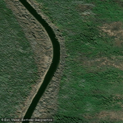
The Little Buffalo River in the Northwest Territories offers a short, accessible whitewater run below its namesake falls, located approximately 51–52 km northwest of Fort Smith along NWT Highway 5. The run is 2 km in length and is characterized by small riffles and modest wave trains through a forested corridor. The channel is tight, and the surrounding boreal forest — much of it recovering from past fire damage — presses in closely on both banks, giving the run a focused, creek-like feel despite its modest difficulty.
The put-in sits directly below Little Buffalo Falls, which drop through a narrow canyon of curved sandstone and limestone. Reaching the water requires carrying a boat approximately 20 metres down a steep trail along a crumbly sandstone and limestone bank, beginning from Little Buffalo Falls Territorial Park. The takeout is at a boat launch connected to the campground by an unmaintained gravel road, and most paddlers set shuttle there and complete two or three laps in a single session.
The primary season for this run is mid to late May, when snowmelt brings water levels high enough to make the rapids runnable. Water temperatures remain cold even in late spring. The run is considered beginner-level for experienced whitewater paddlers, but cold water and the persistent risk of fallen trees, strainers, and entrapment hazards — exacerbated by fire-damaged trees along the banks — demand attentiveness. Otters and beavers are frequently observed along the lower portion of the run.
Little Buffalo Falls Territorial Park provides the main staging area and includes six non-powered pull-through campsites, washrooms, a kitchen shelter, picnic area, boat launch, and interpretive displays. The park operates from May 15 to September 15 and uses self-registration with no on-site operator.
For paddlers seeking a longer commitment, it is possible to continue downstream from the falls run, paddling and portaging to Little Buffalo River Crossing Territorial Park and eventually to Fort Resolution on Great Slave Lake — a multi-day trip of roughly five days. Little Buffalo River Crossing Territorial Park, located 20 km south of Fort Resolution via NWT Highway 6, serves as the downstream terminus and offers 20 powered campsites, showers, a boat launch, and picnic facilities.
Water access, boat ramps & amenities
Learn how to get on Little Buffalo River. Uncover great paddling access points, boat ramps, and all the facilities you need for an unforgettable day on the water. Some locations shown may border or include private property. Always check property boundaries and applicable regulations before visiting. PaddleWays's Public & Private Land layer can help you plan your access with confidence.
Paddle smarter with real-time insights
Whether you're en route and conditions shift or you're looking for the best spot based on current flows, we enable you to make informed decisions on the fly.







Nt licenses and regulations
No licenses or regulations available for Nt.
Find Places to Paddle

Over 400,000 Places to Paddle
Every user gets free access to launch points, boat ramps, and public property parcels.


Water and weather conditions (10 day forecast)
See the best times to paddle Little Buffalo River and check the forecast before you go.
No forecast data available.
Explore Nt waters
Top paddling waters
No waters available right now.
Popular Cities
Loading popular cities...
Explore near Little Buffalo River
Nearby waters
More in Nt

Smarter Paddling Starts in the App.
Paddleways gives you everything you need to plan smarter, paddle better, and own every trip from first launch to takeout.