La Pérouse Bay
- Saltwater
- Bay
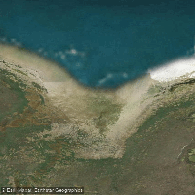
La Pérouse Bay
- Saltwater
- Bay
- Sq. miles
- 7.7
- Boat Ramps
- 0
- Access Points
- 0
- Campsites
- 0
La Pérouse Bay is located on the west coast of Hudson Bay in Nunavut, near the border with Manitoba. The coastline in this area, from Cape Churchill westward past La Pérouse Bay to Watson Point, Gordon Point, and Halfway Point, is low and swampy. This topography suggests limited natural high-ground launch points, requiring paddlers to plan for extensive tidal flats. The foreshore consists of flats of sand and mud covered with boulders, which extend up to 3.5 miles offshore. These extensive shallows create a significant hazard, as depths of less than 6 fathoms (11 meters) exist up to 6.5 miles offshore near Watson Point and up to 8 miles off between Watson Point and Halfway Point. The adjacent Churchill Shoals present a further danger, with depths of 3 fathoms (5.5 m) and less extending up to 5 miles off Gordon Point; vessels are advised to stay outside the 10-fathom (18.3 m) line to avoid these hazards. The bay experiences a substantial tidal range, and the vast intertidal zone means paddlers must carefully time their trips to avoid being stranded far from shore on drying mud and sand flats littered with boulders. The area is exposed to the full fetch of Hudson Bay, making it susceptible to strong winds and building steep, hazardous waves, particularly given the shallow approach. The region is noted for significant snow goose populations and related ecological research. Paddlers should be aware that the parallel of 60°N, about 4 miles north of Egg River to the south, marks the boundary between Nunavut and Manitoba.
Water access, boat ramps & amenities
Learn how to get on La Pérouse Bay. Uncover great paddling access points, boat ramps, and all the facilities you need for an unforgettable day on the water. Some locations shown may border or include private property. Always check property boundaries and applicable regulations before visiting. PaddleWays's Public & Private Land layer can help you plan your access with confidence.
Paddle smarter with real-time insights
Whether you're en route and conditions shift or you're looking for the best spot based on current flows, we enable you to make informed decisions on the fly.








Find Places to Paddle

Over 400,000 Places to Paddle
Every user gets free access to launch points, boat ramps, and public property parcels.


Tides, wind & water conditions (10 day forecast)
On open water, wind and tide matter as much as the weather. See the best times to paddle La Pérouse Bay and check the marine forecast before you launch.
Loading tide predictions…
Explore Nu waters
Top paddling waters
No waters available right now.
Popular Cities
Loading popular cities...
Explore near La Pérouse Bay
Nearby waters
More in Nu

Smarter Paddling Starts in the App.
Paddleways gives you everything you need to plan smarter, paddle better, and own every trip from first launch to takeout.