Nueltin Lake
Nueltin Lake
- Boat Ramps
- 0
- Access Points
- 0
- Campsites
- 0
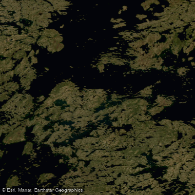
Nueltin Lake is a massive, remote body of water straddling the Manitoba–Nunavut border, sitting at the transition between boreal forest and open tundra. The lake is extraordinarily large and complex, with one early explorer estimating its length at between 120 and 180 miles, and its shoreline is characterized by countless bays, inlets, and islands that make navigation genuinely challenging. The northern section opens into full tundra country, where trees give way to stunted shrubs and the landscape becomes increasingly exposed.
Access is exclusively by float plane, with Thompson, Manitoba serving as the primary staging point, roughly 350 kilometers to the south. Lynn Lake is another noted departure base. There is no road access to the lake whatsoever. Egress from downstream routes typically involves chartered motorboat transport to Arviat, Nunavut, followed by commercial aviation.
The paddling season opens in late June once ice clears, with peak conditions through July and August. Ice is a serious and persistent hazard: floating ice offshore and late-season ice floes have trapped paddlers for multiple days even well into the season. Wind is equally significant — sustained winds of 40 kph or more can pin paddlers in camp for entire days, and the lake's size and exposure make large crossings genuinely dangerous. Full self-sufficiency, satellite communications, and pre-arranged float plane pickup are considered essential for any trip.
Nueltin Lake sits within the migration range of the Beverly and Qamanirjuaq barren-ground caribou herds, and wolves are present on the tundra. Bears are also a documented concern, with at least one abandoned lodge on the lake reported to have been destroyed by bears. The Robertson esker, a 130-kilometer glacially formed ridge, passes just south of the lake and is a notable landscape feature.
The lake is a well-regarded fishery for lake trout, northern pike, and Arctic grayling. Treeline Lodge, a fly-in fishing operation on the lake, instituted a catch-and-release policy in 1978, making Nueltin the first lake in Canada with such a distinction. Biting insects — blackflies and mosquitoes — are at peak intensity in late June and remain a persistent presence through the summer. Water levels can vary significantly from year to year, with high water submerging shoreline vegetation and producing fast, challenging river conditions on connecting waterways.
Water access, boat ramps & amenities
Learn how to get on Nueltin Lake. Uncover great paddling access points, boat ramps, and all the facilities you need for an unforgettable day on the water. Some locations shown may border or include private property. Always check property boundaries and applicable regulations before visiting. PaddleWays's Public & Private Land layer can help you plan your access with confidence.
Paddle smarter with real-time insights
Whether you're en route and conditions shift or you're looking for the best spot based on current flows, we enable you to make informed decisions on the fly.








Find Places to Paddle

Over 400,000 Places to Paddle
Every user gets free access to launch points, boat ramps, and public property parcels.


Water and weather conditions (10 day forecast)
See the best times to paddle Nueltin Lake and check the forecast before you go.
No forecast data available.
Explore Nu waters
Top paddling waters
No waters available right now.
Popular Cities
Loading popular cities...
Explore near Nueltin Lake
Nearby waters
More in Nu

Smarter Paddling Starts in the App.
Paddleways gives you everything you need to plan smarter, paddle better, and own every trip from first launch to takeout.