Boyne Estuary
- Saltwater
- Estuary
Boyne Estuary
- Saltwater
- Estuary
- Sq. miles
- 1.2
- Boat Ramps
- 0
- Access Points
- 0
- Campsites
- 0
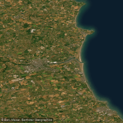
The Boyne Estuary is the tidal, saltwater mouth of the River Boyne where it meets the Irish Sea at the historic port town of Drogheda, straddling the counties of Meath and Louth. For paddlers, this is a dynamic marine environment with significant tidal influence. Key public access points for launching small craft like kayaks include a slipway at Baltray on the northern shore and the Coast Guard slip within Drogheda itself. The Baltray slip is not viable at low tide, making tide timing critical for trip planning. The estuary is an important commercial port, so paddlers must anticipate and avoid significant boat traffic, particularly near Drogheda. The area is exposed to the open Irish Sea, with Clogher Head to the north providing a prominent rocky headland that can be paddled around from Port Oriel harbour, offering views of sea cliffs and caves. The estuary's mouth, between Baltray and Mornington, is known for active water conditions and is a noted area for bass, indicating potential fish activity for paddlers to observe.
Paddling here connects you directly to layers of history, from Viking ship remains discovered in the riverbed to the iconic Boyne Viaduct and bridges in Drogheda that may require mast lowering for sailing craft. Upstream from the Coast Guard slip, paddlers can continue under the bridges to reach the sea lock for the Boyne Navigation, a restored inland waterway. The surrounding landscape features sandy beaches like the Blue Flag beach at Clogherhead and extensive mudflats, which are rich in wildfowl. Water quality is not explicitly detailed, but the estuary's status as a commercial port and centre of industry suggests paddlers should be mindful of general cleanliness. The best conditions for a calm paddle are likely on a flooding tide, and trips can be coordinated with community clean-up events that occur monthly. The overall experience is one of paddling through a working waterway steeped in maritime and archaeological significance, where careful attention to tides, commercial traffic, and weather exposure is essential for safety.
Water access, boat ramps & amenities
Learn how to get on Boyne Estuary. Uncover great paddling access points, boat ramps, and all the facilities you need for an unforgettable day on the water. Some locations shown may border or include private property. Always check property boundaries and applicable regulations before visiting. PaddleWays's Public & Private Land layer can help you plan your access with confidence.
Paddle smarter with real-time insights
Whether you're en route and conditions shift or you're looking for the best spot based on current flows, we enable you to make informed decisions on the fly.







Co. Meath licenses and regulations
No licenses or regulations available for Co. Meath.
Find Places to Paddle

Over 400,000 Places to Paddle
Every user gets free access to launch points, boat ramps, and public property parcels.


Tides, wind & water conditions (10 day forecast)
On open water, wind and tide matter as much as the weather. See the best times to paddle Boyne Estuary and check the marine forecast before you launch.
Loading tide predictions…
Paddling near Boyne Estuary
Boyne
Liffey
Louth Coast (HA 06)
Dodder

Inny [Shannon]
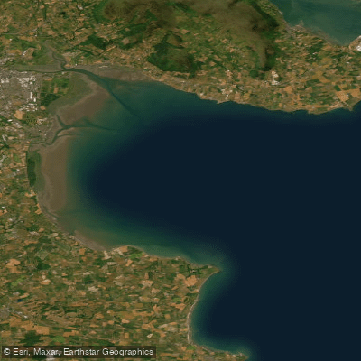
Outer Dundalk Bay
Nanny [Meath]
Rye Water
Fane
Explore Meath waters
Top paddling waters
No waters available right now.
Popular Cities
Loading popular cities...
Explore near Boyne Estuary
Nearby waters
More in Co. Meath

Smarter Paddling Starts in the App.
Paddleways gives you everything you need to plan smarter, paddle better, and own every trip from first launch to takeout.