Paddling in Ohio
- Lakes
- 1,233
- Rivers
- 4,298
- Access
- 539
- Boat Ramps
- 1,493
- Shops
- 17
Ohio is a flatwater state at heart — a dense mesh of creeks, rivers, and reservoirs stitched together by one of the country's most developed state water trail systems — with a scrappy, rain-chased whitewater scene and a legitimate sea kayaking archipelago bolted onto its edges.
The center of gravity is the livery culture. The Mohican, the Hocking, and the Little Miami have been moving boats downstream for generations, and for a lot of Ohioans a summer float on one of them is how paddling starts.
The Little Miami carries both state and national Scenic River designations and runs Class I for 86 miles out toward Cincinnati; the Hocking threads the sandstone country of the Hocking Hills with sandbars for lunch stops and short hikes to features like Rockbridge.
ODNR's water trails program — more than 1,000 signed miles across 17-plus trails, with brochures, hazard markings, and gauge references — is the connective tissue. The Olentangy runs right through Ohio State's campus.
The Tuscarawas was added in 2020 and keeps gaining access points.
And the Muskingum does something no other state can match: 112 miles from Dresden to Marietta through ten hand-operated locks, built in the 1840s and still worked by ODNR lock keepers on weekends, with free primitive camping at locks 2 through 8 for through-boaters.
You lock through. You camp at the lockmaster's yard. It's a serious multi-day trip on flatwater. The whitewater is real but narrow. Ohio's creeks are rain- and snowmelt-dependent, and the window is late winter into spring — February through April, mostly.
The Cuyahoga Upper Gorge through downtown Cuyahoga Falls is the flagship, Class IV–V+ with named drops, a permit requirement, and a hard dependency on flow; the Akron Watershed Division sometimes helps with releases for the Cuyahoga Falls Fest.
Tinkers Creek, the Black River falls, Backbone Creek, and Rocky Fork (250–600 CFS is the recreational window) round out a community that lives on USGS gauges and mobilizes on a day's notice.
The Keel-Haulers Canoe Club, founded in 1967, anchors the scene — they wrote the Keel-Haulers River Rating Scale that fed into national self-assessment culture, and they're still active on dam removal advocacy along the Cuyahoga.
Lake Erie is its own discipline. The five circular island trails — South Bass, Middle Bass, North Bass, Kelleys, and the Catawba/Marblehead peninsula — offer limestone shorelines, alvar preserves, and the 11. 8-mile loop around Kelleys.
The western basin is shallow, which means waves stack up short and steep, and ferry traffic is constant. The Catawba-to-South Bass crossing is 2. 5 miles of exposed water; mainland to Kelleys is 5 or 6.
The South Bass Island Kayak Rendezvous each June is where that community gathers. Two festivals tell you most of what you need to know about Ohio's paddling identity.
Blazing Paddles in July puts kayaks, canoes, SUPs, and surf skis on a Cuyahoga that once caught fire.
The Ohio River Paddlefest the first Saturday in August closes the river through downtown Cincinnati to motor traffic for 2,000 paddlers, with proceeds funding outdoor education for city teens.
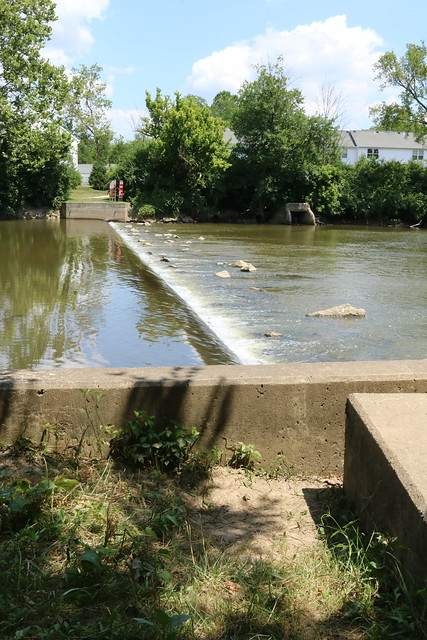
A burned river that paddlers now celebrate, and the country's biggest paddling party rolling through a major American downtown — that's the state in two weekends. One practical note: lowhead dams are everywhere.
Every major river system has them, some unportageable. Read the ODNR maps before you launch.
Paddle smarter with real-time insights
Whether you're en route and conditions shift or you're looking for the best spot based on current flows, we enable you to make informed decisions on the fly.







Ohio licenses and regulations
National parks in Ohio
Explore Ohio waters
Top paddling waters
Popular Cities
Loading popular cities...

Smarter Paddling Starts in the App.
Paddleways gives you everything you need to plan smarter, paddle better, and own every trip from first launch to takeout.