Río Bermejito (Antiguo cauce)
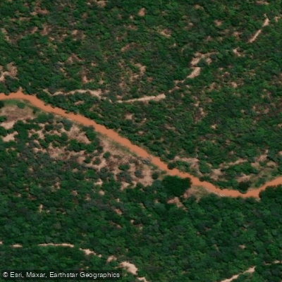
Río Bermejito (Antiguo cauce)
- Boat Ramps
- 0
- Access Points
- 0
- Campsites
- 0
The Río Bermejito is the former channel of the Río Bermejo, now an intermittent, meandering waterway that crosses Chaco Province near the El Impenetrable jungle. In the plains of Argentina's Gran Chaco, the Bermejo splits into two branches; the Bermejito is the older southern branch, while the Teuco (Bermejo Nuevo) forms the active northern branch. The two rejoin near Villa Río Bermejito. During the summer rainy season, the Bermejito functions as a secondary arm of the Bermejo, carrying significant sediment loads that sustain the gallery forests lining its banks. Outside of the wet season it is intermittent, so water levels and navigability vary considerably by time of year.
The river is characterized by calm, dark water that reflects the dense monte chaqueño vegetation on either side. Its course is notably sinuous and winding, with the channel looping around and effectively surrounding the town of Villa Río Bermejito on multiple sides. The banks are densely vegetated and largely undisturbed, giving paddlers a strong sense of isolation from the surrounding landscape.
Excursions on the river are coordinated from Villa Río Bermejito, which serves as the primary access point. Trips typically run three to four hours and can be done by kayak or motorboat. The pace is unhurried, suited to observation rather than distance. Wildlife along the banks includes herons, toucans, black howler monkeys, capybaras (carpinchos), and yacaré caimans. Bird calls are audible throughout any paddle.
The town of Villa Río Bermejito is reached from Resistencia, the provincial capital, via Ruta Provincial 90 and Ruta Provincial 3, a distance of approximately 270 kilometers. The town sits at an altitude of 111 meters above sea level and has a subtropical climate. A municipal campground with sanitary facilities, showers, and laundry sinks is available, and a wooden boardwalk runs along the riverbank at the camping area. The ruins of the former colonial settlement of La Cangayé are located on the river's shores. The Qom indigenous communities in the area are culturally significant to the region.
Water access, boat ramps & amenities
Learn how to get on Río Bermejito (Antiguo cauce). Uncover great paddling access points, boat ramps, and all the facilities you need for an unforgettable day on the water. Some locations shown may border or include private property. Always check property boundaries and applicable regulations before visiting. PaddleWays's Public & Private Land layer can help you plan your access with confidence.
Paddle smarter with real-time insights
Whether you're en route and conditions shift or you're looking for the best spot based on current flows, we enable you to make informed decisions on the fly.







Chaco licenses and regulations

Find Places to Paddle

Over 400,000 Places to Paddle
Every user gets free access to launch points, boat ramps, and public property parcels.


Water and weather conditions (10 day forecast)
See the best times to paddle Río Bermejito (Antiguo cauce) and check the forecast before you go.
No forecast data available.
Paddling near Río Bermejito (Antiguo cauce)
Explore Chaco waters
Top paddling waters
No waters available right now.
Popular Cities
Loading popular cities...
Explore near Río Bermejito (Antiguo cauce)
Nearby waters
More in Chaco

Smarter Paddling Starts in the App.
Paddleways gives you everything you need to plan smarter, paddle better, and own every trip from first launch to takeout.