Río Limay
Río Limay
- Boat Ramps
- 1
- Access Points
- 0
- Campsites
- 10
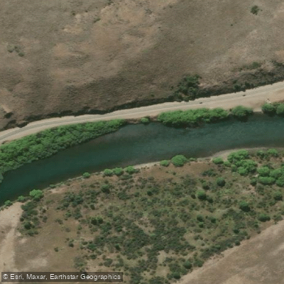
The Río Limay originates where the waters of Lago Nahuel Huapi spill out near Bariloche, flowing approximately 430 kilometers northeast through increasingly arid Patagonian steppe before joining the Río Neuquén to form the Río Negro. The river is large and powerful, characterized by a complex mix of currents and seams that give it a demanding, high-volume character. Its sheer size and volume make it one of the more formidable rivers in Patagonia.
For paddlers, the upper section near Bariloche offers a relatively accessible starting point. The put-in at Rincón Chico, located just outside the city, is a commonly used launch site and provides a gentle introduction to river paddling on the Limay. The boca — where the river exits Lago Nahuel Huapi — is only about 16 kilometers east of Bariloche, with public access on both sides of the stony shoreline. This upper reach is suitable for kayaking and introductory river canoeing, with dramatic Patagonian scenery throughout.
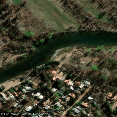
The middle section of the Limay runs along Ruta 237, which provides the primary road access to the river. However, most riverbank access along this stretch is private. Some landowners will grant access for a small fee or upon request, but floating the river by boat is the most practical way to experience this section. The towns of Bariloche and Piedra del Aguila serve as the main bases for the upper and middle sections respectively, with a range of accommodation options in both.
The river corridor passes through high-desert steppe landscape, and the scenery along the middle and lower reaches takes on a distinctly arid character compared to the forested upper section near Bariloche. The river's size and the remoteness of much of its course mean that paddlers should be well prepared and experienced in reading large, complex water. Commercial kayak and rafting operations based in Bariloche offer guided trips on the river for those seeking organized outings.
Water access, boat ramps & amenities
Learn how to get on Río Limay. Uncover great paddling access points, boat ramps, and all the facilities you need for an unforgettable day on the water. Some locations shown may border or include private property. Always check property boundaries and applicable regulations before visiting. PaddleWays's Public & Private Land layer can help you plan your access with confidence.
Paddle smarter with real-time insights
Whether you're en route and conditions shift or you're looking for the best spot based on current flows, we enable you to make informed decisions on the fly.







Neuquén licenses and regulations

Find Places to Paddle

Over 400,000 Places to Paddle
Every user gets free access to launch points, boat ramps, and public property parcels.


Water and weather conditions (10 day forecast)
See the best times to paddle Río Limay and check the forecast before you go.
No forecast data available.
Explore Neuquén waters
Top paddling waters
No waters available right now.
Popular Cities
Loading popular cities...
Explore near Río Limay
Access points
More in Neuquén

Smarter Paddling Starts in the App.
Paddleways gives you everything you need to plan smarter, paddle better, and own every trip from first launch to takeout.