Rio Jauaperi
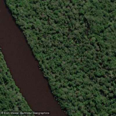
Rio Jauaperi
- Boat Ramps
- 0
- Access Points
- 0
- Campsites
- 0
The Rio Jauaperi forms the border between the states of Amazonas and Roraima in Brazil, flowing as a black-water tributary of the Rio Negro just south of the white-water Rio Branco. The river lies within the Lower Rio Branco-Jauaperi Extractive Reserve (Resex), a 581,173-hectare protected area established in June 2018 following two decades of advocacy by local communities. The river corridor also passes through or near other protected zones including the Baixo Rio Branco and Anauá National Forest, and approaches the indigenous territory of the Waimiri Atroari near its lower reaches.
A common put-in for guided expeditions is the bridge over the Jauaperi River in Roraima, approximately 440 km from Manaus — roughly seven hours by road. Paddlers typically travel downstream over 7 to 10 days, covering stretches of around 200 km before exiting via a 45 km dirt road (BR-431) to Comunidade Jundiá, then continuing approximately 351 km via BR-174 back to Manaus, with a total return drive of about six and a half hours. One early landmark is the Travessão waterfall, roughly 7 km from the starting point, notable for its rounded rock formations.
The river is characterized by extreme remoteness. Days can pass with only occasional local fishing boats in sight. Water color varies along the river from crystal clear to white to nearly black. The river supports more than 40 identified mammal species, ten of which appear on the IUCN endangered species list. Wildlife encounters can include giant otters, pink and tucuxi dolphins, manatees, howler monkeys, macaws, caimans, and piranha. The surrounding forest is primary Amazon rainforest with rich plant diversity.
Fewer than a thousand traditional inhabitants live along the river across approximately ten communities, subsisting on forest products and fishing. Commercial, ornamental, and sport fishing have been subject to legal restrictions, with a court injunction banning non-subsistence fishing in the area. Paddlers should be aware that mosquito presence is rated at maximum intensity. Internal combustion engines are prohibited in certain sections of the reserve, which contributes to the river's quiet character. Guided expeditions typically involve camping in hammocks and require a minimum group of two people.
Water access, boat ramps & amenities
Learn how to get on Rio Jauaperi. Uncover great paddling access points, boat ramps, and all the facilities you need for an unforgettable day on the water. Some locations shown may border or include private property. Always check property boundaries and applicable regulations before visiting. PaddleWays's Public & Private Land layer can help you plan your access with confidence.
Paddle smarter with real-time insights
Whether you're en route and conditions shift or you're looking for the best spot based on current flows, we enable you to make informed decisions on the fly.







Amazonas licenses and regulations
No licenses or regulations available for Amazonas.
Find Places to Paddle

Over 400,000 Places to Paddle
Every user gets free access to launch points, boat ramps, and public property parcels.


Water and weather conditions (10 day forecast)
See the best times to paddle Rio Jauaperi and check the forecast before you go.
Fazenda São José
All Flow Stations
Explore Amazonas waters
Top paddling waters
No waters available right now.
Popular Cities
Loading popular cities...
Explore near Rio Jauaperi
Nearby waters
More in Amazonas

Smarter Paddling Starts in the App.
Paddleways gives you everything you need to plan smarter, paddle better, and own every trip from first launch to takeout.