Rio Itapecuru
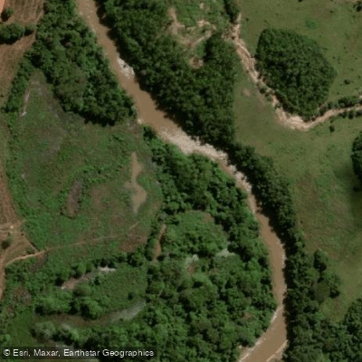
Rio Itapecuru
- Boat Ramps
- 0
- Access Points
- 0
- Campsites
- 0
The Rio Itapecuru is a major river in Maranhão state, northern Brazil, stretching approximately 1,041 kilometers from its headwaters in the Serra da Crueira in the south to its mouth at Baía do Arraial, an arm of the larger Baía de São José southeast of the Ilha do Maranhão. The river flows in a broadly south-to-north direction and carries an average discharge of around 470 cubic meters per second. Its width ranges between 50 and 120 meters along much of its course, giving it a substantial channel suited to open-water paddling rather than technical whitewater.
The river drains a basin of roughly 53,000 square kilometers and serves as a critical freshwater source for some twenty municipalities, including São Luís. The headwaters are partially protected within the Mirador State Park, a 437,000-hectare reserve established in 1980. The lower reaches pass through transitional forest containing elements of both Amazonian flora and cerrado (savannah-like) vegetation, which shapes the riparian landscape paddlers would encounter in that section.
Historically, the Itapecuru was central to Maranhão's colonial economy, particularly cotton cultivation, and towns such as Caxias and Itapecuru-Mirim developed along its banks as commercial centers. This historical presence means the river corridor passes through or near several established settlements, which may offer logistical support for multi-day trips.
Formal access points, documented hazards, and regulated put-in or take-out locations vary along the river. Paddlers planning a trip should consult local outfitters or Brazilian waterway authorities, and note that recreational vessels operating in Brazilian waters require a Vessel Inscription Title (TIE/TIEM) issued through the Brazilian Navy's Directorate of Ports and Coasts.
Water access, boat ramps & amenities
Learn how to get on Rio Itapecuru. Uncover great paddling access points, boat ramps, and all the facilities you need for an unforgettable day on the water. Some locations shown may border or include private property. Always check property boundaries and applicable regulations before visiting. PaddleWays's Public & Private Land layer can help you plan your access with confidence.
Paddle smarter with real-time insights
Whether you're en route and conditions shift or you're looking for the best spot based on current flows, we enable you to make informed decisions on the fly.







Maranhão licenses and regulations
No licenses or regulations available for Maranhão.
Find Places to Paddle

Over 400,000 Places to Paddle
Every user gets free access to launch points, boat ramps, and public property parcels.


Water and weather conditions (10 day forecast)
See the best times to paddle Rio Itapecuru and check the forecast before you go.
São Felinho
All Flow Stations
Paddling near Rio Itapecuru
Explore Maranhão waters
Top paddling waters
No waters available right now.
Popular Cities
Loading popular cities...
Explore near Rio Itapecuru
Nearby waters
More in Maranhão

Smarter Paddling Starts in the App.
Paddleways gives you everything you need to plan smarter, paddle better, and own every trip from first launch to takeout.