Black Wolf Creek
Black Wolf Creek
- Boat Ramps
- 0
- Access Points
- 0
- Campsites
- 0
Black Wolf Creek, known as Dı́ga Dezene Deé to the Sahtu Dene First Nation, is a remote whitewater creek flowing through the backcountry of Nááts'įhch'oh National Park Reserve in the Northwest Territories. The creek runs approximately 60 kilometres before joining the Broken Skull River, draining cold, clear water from high in the Mackenzie Mountains.
Access to Black Wolf Creek requires significant logistical commitment. The typical approach involves a floatplane followed by several days of paddling the Broken Skull River, then a multi-day hike up an untracked valley to reach the headwaters near Nááts'įhch'oh lake. An alternative approach documented by packrafters begins at MacMillan Pass, linking paddle and hiking segments across the Mackenzie Mountains. The creek originates as a shallow trickle leaving Grizzly Lake before building volume and gradient through a series of distinct canyons. The GPS coordinates for the confluence with the Broken Skull River are approximately 62°18.44'N, 127°39.02'W, and the relevant NTS map sheets are 95 L/12 and 95 L/5.
The whitewater character is predominantly Class III-IV, punctuated by at least one Class V canyon that previous groups have portaged. The water is cold and fast throughout. Paddlers should be prepared to scout extensively; the creek's remote canyon sections leave little margin for error. Wood hazards and braided channels become a concern as the creek fans out near its confluence with the Broken Skull River, where mixing currents add additional complexity.
With only a handful of recorded descents as of the mid-2020s, beta is limited. The first recorded descent was completed by packrafters, and the route is considered a technical creek suited to packraft-style craft. The surrounding terrain offers hot springs in the approach valley near Grizzly Lake. The area falls within Nááts'įhch'oh National Park Reserve, and paddlers should consult Parks Canada regarding any applicable regulations before planning a trip. Given the extreme remoteness, self-sufficiency and thorough preparation are essential. Local guide services have historically cautioned against the route, underscoring the seriousness of the undertaking.
Water access, boat ramps & amenities
Learn how to get on Black Wolf Creek. Uncover great paddling access points, boat ramps, and all the facilities you need for an unforgettable day on the water. Some locations shown may border or include private property. Always check property boundaries and applicable regulations before visiting. PaddleWays's Public & Private Land layer can help you plan your access with confidence.
Paddle smarter with real-time insights
Whether you're en route and conditions shift or you're looking for the best spot based on current flows, we enable you to make informed decisions on the fly.







Nt licenses and regulations
No licenses or regulations available for Nt.
Find Places to Paddle

Over 400,000 Places to Paddle
Every user gets free access to launch points, boat ramps, and public property parcels.


Water and weather conditions (10 day forecast)
See the best times to paddle Black Wolf Creek and check the forecast before you go.
No forecast data available.
Paddling near Black Wolf Creek
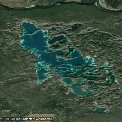
Explore Nt waters
Top paddling waters
No waters available right now.
Popular Cities
Loading popular cities...
Explore near Black Wolf Creek
Nearby waters
More in Nt
Smarter Paddling Starts in the App.
Paddleways gives you everything you need to plan smarter, paddle better, and own every trip from first launch to takeout.