Bousso River
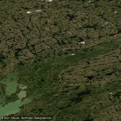
Bousso River
- Boat Ramps
- 0
- Access Points
- 0
- Campsites
- 0
The Bousso River flows through the taiga shield country north of Behchoko (formerly Rae) in the Northwest Territories. Geological Survey of Canada reports from the 1930s described it as a good route for light canoes to explore this region, and it has been paddled by groups from Behchoko in more recent years.
The upper Bousso proper presents serious obstacles and should not be treated as a navigable canoe route. An exploration of the river above its confluence with the lake system connecting to Russell Lake revealed that, after a promising initial stretch, the river becomes choked with deadfalls and sweepers. The first significant rapid can be portaged through open forest, but the second requires substantial clearing work, and the third is effectively impassable without heavy equipment. No evidence of historical portage trails was found along this upper section.
The Bousso is more commonly encountered as part of a longer circuit rather than as a destination in itself. One established route descends the "Small River" from near Snare Lake to the Bousso, then continues down to Russell Lake and Marian Lake, finishing at the Yellowknife highway bridge near Edzo — a paddle of approximately 60 kilometres along Russell and Marian Lakes alone. This broader corridor through interconnected lakes, quiet streams, and portages is characteristic of classic taiga shield travel in the region.
Paddlers considering routes in this area should be prepared for wilderness travel with no established facilities, and should account for the possibility of significant bush work if exploring off the main lake chain.
Water access, boat ramps & amenities
Learn how to get on Bousso River. Uncover great paddling access points, boat ramps, and all the facilities you need for an unforgettable day on the water. Some locations shown may border or include private property. Always check property boundaries and applicable regulations before visiting. PaddleWays's Public & Private Land layer can help you plan your access with confidence.
Paddle smarter with real-time insights
Whether you're en route and conditions shift or you're looking for the best spot based on current flows, we enable you to make informed decisions on the fly.







Nt licenses and regulations
No licenses or regulations available for Nt.
Find Places to Paddle

Over 400,000 Places to Paddle
Every user gets free access to launch points, boat ramps, and public property parcels.


Water and weather conditions (10 day forecast)
See the best times to paddle Bousso River and check the forecast before you go.
No forecast data available.
Paddling near Bousso River
Explore Nt waters
Top paddling waters
No waters available right now.
Popular Cities
Loading popular cities...
Explore near Bousso River
Nearby waters
More in Nt

Smarter Paddling Starts in the App.
Paddleways gives you everything you need to plan smarter, paddle better, and own every trip from first launch to takeout.