Snare River
Snare River
- Boat Ramps
- 0
- Access Points
- 0
- Campsites
- 0
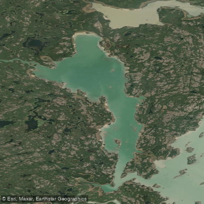
The Snare River flows approximately 375 kilometres southwest from its headwaters near Jolly Lake, northeast of Great Slave Lake, through a chain of large lakes and connecting river sections to Behchoko on the North Arm of Great Slave Lake. The river is located in the Mackenzie District of the Northwest Territories, with headwaters roughly 160 kilometres from Yellowknife. The standard paddling route covers approximately 350 kilometres from Winter Lake to Behchoko and takes around 16 days to complete.
The upper half of the route crosses a series of large lakes — Winter, Roundrock, Snare, Indin, and Kwejinne — connected by short river stretches with rapids at the outlets. The landscape in this section is semi-barren tundra and Canadian Shield rock, transitioning to boreal spruce forest further south. Below Kwejinne Lake, the river passes through Big Spruce Lake and then enters the Snare Hydro system, where four hydroelectric dams operated by the Northwest Territories Power Corporation take nearly all of the drop out of the river. Each dam requires a portage on the left bank. Paddlers should be aware that the Power Corporation may spill water without warning, which can flood campsites or make rapids impossible to navigate. Tlicho groups travelling this route traditionally receive rides around the dam section on the service road, and portage trails in this area may be nonexistent or overgrown.
One of the most technically demanding sections is a 29-kilometre canyon-like stretch that can be paddled or avoided via an overland portage through several small lakes at the end of Snare Lake. This alternative portage involves approximately ten carries, the first two of which are straightforward, while the remaining eight are unmarked and arduous. Below the gorge, the river opens into Indin Lake, with several rapids and falls requiring lining or portaging. The final 64 kilometres from Slemon Lake is open flatwater across Russell and Marian Lakes, which are wide and exposed to southerly headwinds; early morning travel is advisable on this section. The put-in is typically at Winter Lake, accessed by floatplane from Yellowknife, and the take-out is at Behchoko, which has road access to Yellowknife via Highway 3. The river has historical significance as a traditional Tlicho travel corridor between Behchoko and Wekweeti. Fishing along the route is noted as superb, with Arctic grayling among the species present.
Water access, boat ramps & amenities
Learn how to get on Snare River. Uncover great paddling access points, boat ramps, and all the facilities you need for an unforgettable day on the water. Some locations shown may border or include private property. Always check property boundaries and applicable regulations before visiting. PaddleWays's Public & Private Land layer can help you plan your access with confidence.
Paddle smarter with real-time insights
Whether you're en route and conditions shift or you're looking for the best spot based on current flows, we enable you to make informed decisions on the fly.







Nt licenses and regulations
No licenses or regulations available for Nt.
Find Places to Paddle

Over 400,000 Places to Paddle
Every user gets free access to launch points, boat ramps, and public property parcels.


Water and weather conditions (10 day forecast)
See the best times to paddle Snare River and check the forecast before you go.
No forecast data available.
Paddling near Snare River
Explore Nt waters
Top paddling waters
No waters available right now.
Popular Cities
Loading popular cities...
Explore near Snare River
Nearby waters
More in Nt

Smarter Paddling Starts in the App.
Paddleways gives you everything you need to plan smarter, paddle better, and own every trip from first launch to takeout.