Shallow Bay
- Saltwater
- Bay
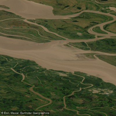
Shallow Bay
- Saltwater
- Bay
- Sq. miles
- 125
- Boat Ramps
- 0
- Access Points
- 0
- Campsites
- 0
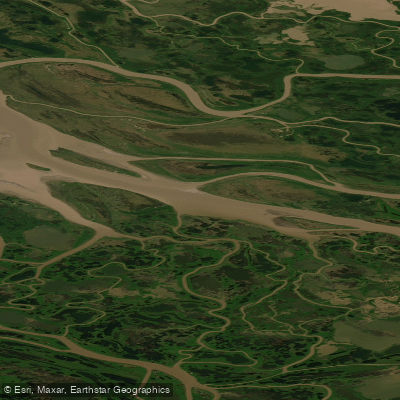
Shallow Bay is located in the Inuvialuit Settlement Region within the Canadian Arctic, situated near the Mackenzie Delta and adjacent to areas like East Mackenzie Bay and Kugmallit Bay. It is a designated coastal zone, forming part of a larger, expansive marine area on the Beaufort Sea shelf. The bay is characterized by its shallow nature, as indicated by its name and its inclusion in a coastal described as a "shallow bay on the coastline." This geography suggests a broad, open bay with significant exposure to wind and waves from the Beaufort Sea, creating conditions where fetch can be considerable. Paddlers must be prepared for remote, cold Arctic waters with no formal access points, launches, or amenities. The area is ecologically significant, identified as an important staging area for migratory birds including greater white-fronted geese, Canada geese, cackling geese, lesser snow geese, and black brants. Marine mammal activity is present, with the bay being part of a monitored area for beluga whales, and historical hydrocarbon exploration has occurred nearby. The region holds cultural importance for the Inuvialuit, with beluga harvests traditionally monitored in this and adjacent bays. Given the extreme northern latitude, the paddling season is severely limited by ice cover, typically to the brief summer months when open water exists. Water temperatures remain cold year-round. This is a remote wilderness destination suitable only for highly experienced, self-sufficient paddlers equipped for expedition-style travel, capable of navigating open saltwater conditions, strong winds, potential fog, and sharing waters with marine traffic related to research and potential resource exploration.
Water access, boat ramps & amenities
Learn how to get on Shallow Bay. Uncover great paddling access points, boat ramps, and all the facilities you need for an unforgettable day on the water. Some locations shown may border or include private property. Always check property boundaries and applicable regulations before visiting. PaddleWays's Public & Private Land layer can help you plan your access with confidence.
Paddle smarter with real-time insights
Whether you're en route and conditions shift or you're looking for the best spot based on current flows, we enable you to make informed decisions on the fly.







Nt licenses and regulations
No licenses or regulations available for Nt.
Find Places to Paddle

Over 400,000 Places to Paddle
Every user gets free access to launch points, boat ramps, and public property parcels.


Tides, wind & water conditions (10 day forecast)
On open water, wind and tide matter as much as the weather. See the best times to paddle Shallow Bay and check the marine forecast before you launch.
Loading tide predictions…
Explore Nt waters
Top paddling waters
No waters available right now.
Popular Cities
Loading popular cities...
Explore near Shallow Bay
Nearby waters
More in Nt

Smarter Paddling Starts in the App.
Paddleways gives you everything you need to plan smarter, paddle better, and own every trip from first launch to takeout.