Nanny Estuary
- Saltwater
- Estuary
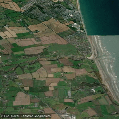
Nanny Estuary
- Saltwater
- Estuary
- Sq. miles
- 0.1
- Boat Ramps
- 0
- Access Points
- 0
- Campsites
- 0
The Nanny Estuary is a coastal saltwater estuary in County Meath, Ireland, flowing into the Irish Sea. It is a designated Special Protected Area for birds, indicating a rich but sensitive environment. The estuary is flanked by the fine sand beach and dunes of Laytown/Bettystown to the north, which serves as a primary coastal access point for paddlers. The estuary's character is defined by its shorelines and salt marshes, which provide a compact but rewarding area for observing coastal wildlife. The presence of Ballygarth Castle along its banks offers a notable historical sight for paddlers to view from the water. As a tidal estuary, paddlers must plan around the significant tidal range and currents of the Irish Sea; timing trips to paddle with the incoming tide is crucial for exploring upstream, while an outgoing tide will assist with a return to the sea. The open mouth of the estuary exposes paddlers to wind and fetch from the Irish Sea, which can quickly create challenging conditions, especially when combined with tidal flow. The adjacent beach at Laytown/Bettystown is having fine sand and no mention of rocky outcrops or significant surf, suggesting a generally gentle gradient suitable for launching and landing, though wind-driven waves can occur. The area is subject to conservation management, including a project to investigate and manage Common cord-grass, and paddlers should minimize disturbance to birdlife. Guided stand-up paddleboard tours are offered in the area, indicating it is a recognized paddling location. Water temperatures follow typical Irish Sea patterns, being coldest in winter and mildest in late summer, necessitating appropriate immersion protection year-round.
Water access, boat ramps & amenities
Learn how to get on Nanny Estuary. Uncover great paddling access points, boat ramps, and all the facilities you need for an unforgettable day on the water. Some locations shown may border or include private property. Always check property boundaries and applicable regulations before visiting. PaddleWays's Public & Private Land layer can help you plan your access with confidence.
Paddle smarter with real-time insights
Whether you're en route and conditions shift or you're looking for the best spot based on current flows, we enable you to make informed decisions on the fly.







Co. Meath licenses and regulations
No licenses or regulations available for Co. Meath.
Find Places to Paddle

Over 400,000 Places to Paddle
Every user gets free access to launch points, boat ramps, and public property parcels.


Tides, wind & water conditions (10 day forecast)
On open water, wind and tide matter as much as the weather. See the best times to paddle Nanny Estuary and check the marine forecast before you launch.
Loading tide predictions…
Paddling near Nanny Estuary
Boyne
Liffey
Louth Coast (HA 06)
Dodder
Nanny [Meath]
Outer Dundalk Bay

Inny [Shannon]
Rye Water
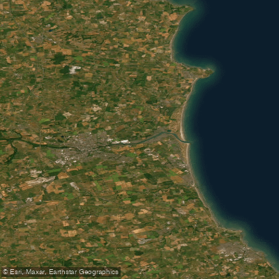
Boyne Estuary
Avonmore
Explore Meath waters
Top paddling waters
No waters available right now.
Popular Cities
Loading popular cities...
Explore near Nanny Estuary

Smarter Paddling Starts in the App.
Paddleways gives you everything you need to plan smarter, paddle better, and own every trip from first launch to takeout.