Tanada Lake
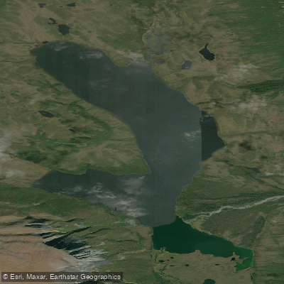
Tanada Lake
- Boat Ramps
- 0
- Access Points
- 0
- Campsites
- 0
Tanada Lake is located in Wrangell-St. Elias National Park in Alaska, situated at an elevation of 2,910 feet. Access to the lake is challenging, with the trailhead located at milepost 24 of Nabesna Road. The trail to Tanada Lake is approximately 15 miles long and presents significant difficulties for hikers due to deep mud bogs, tussocks, and poor drainage. These conditions worsen after rain and heavy use.
The area around Tanada Lake is remote and rugged. The lake itself is at the head of Tanada Creek, about 11 miles west of Nabesna in the Wrangell Mountains. The surrounding landscape offers stunning views of mountains and potentially wildlife, making it a rewarding destination for those who can reach it.
It's crucial to note that the Tanada Lake Trail is closed to recreational off-road vehicle (ORV) use. Hikers who do attempt the trail typically allow 5 to 7 days for the round trip. The recreational trail ends at the confluence of Goat Creek and Pass Creek, marking the Wilderness Preserve Boundary.
For those considering a paddling trip, thorough preparation is essential. The remote location and difficult access mean that self-sufficiency is crucial. Paddlers should be prepared for potentially cold temperatures and changeable weather conditions typical of the Alaskan wilderness.
Before planning any trip, it's advisable to contact the Slana Ranger Station (907-822-7401) or Park Headquarters (907-822-7250) for the most up-to-date information on conditions, regulations, and any necessary permits. Given the challenges of access and the remote nature of the area, Tanada Lake may be best suited for experienced wilderness paddlers comfortable with remote, backcountry conditions.
Water access, boat ramps & amenities
Learn how to get on Tanada Lake. Uncover great paddling access points, boat ramps, and all the facilities you need for an unforgettable day on the water. Some locations shown may border or include private property. Always check property boundaries and applicable regulations before visiting. PaddleWays's Public & Private Land layer can help you plan your access with confidence.
Paddle smarter with real-time insights
Whether you're en route and conditions shift or you're looking for the best spot based on current flows, we enable you to make informed decisions on the fly.








Find Places to Paddle

Over 400,000 Places to Paddle
Every user gets free access to launch points, boat ramps, and public property parcels.


Water and weather conditions (10 day forecast)
See the best times to paddle Tanada Lake and check the forecast before you go.
No forecast data available.
Paddling near Tanada Lake
Explore Alaska waters
Top paddling waters
Popular Cities
Loading popular cities...
Explore near Tanada Lake
Nearby waters
More in Alaska

Smarter Paddling Starts in the App.
Paddleways gives you everything you need to plan smarter, paddle better, and own every trip from first launch to takeout.