Gulkana River
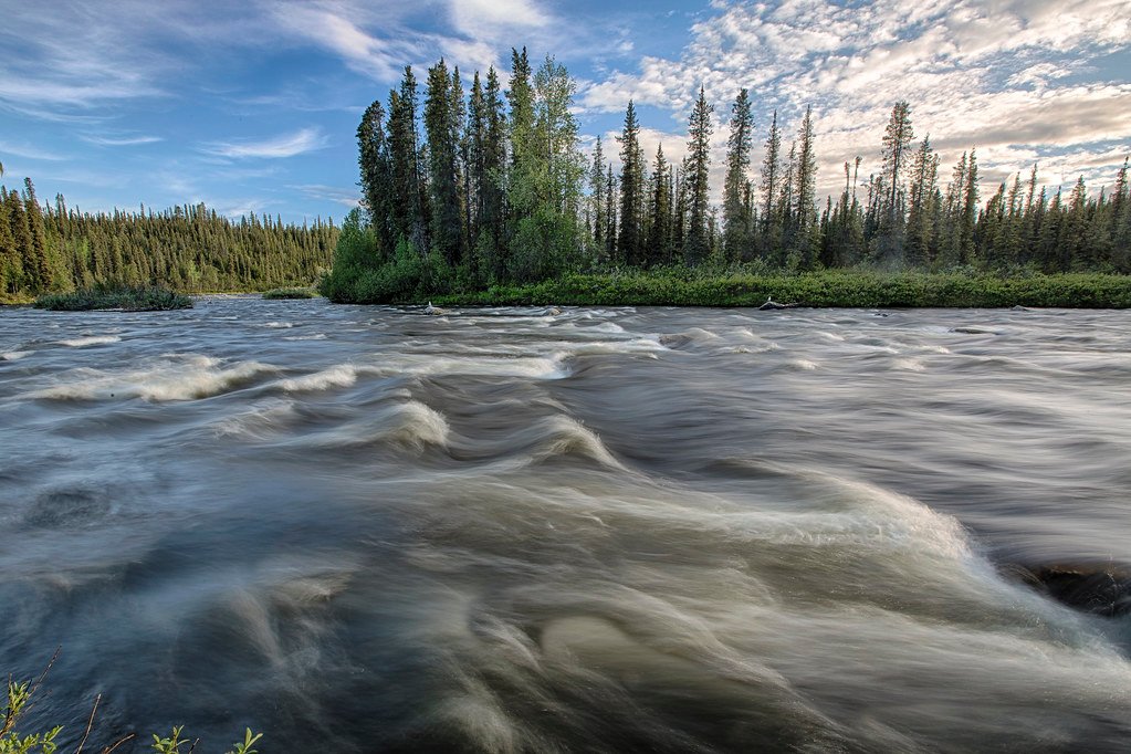
Gulkana River
- Boat Ramps
- 0
- Access Points
- 0
- Campsites
- 50
The Gulkana River flows approximately 80 miles through southcentral Alaska, beginning near Summit Lake in the Alaska Range and traveling south through the Copper River Basin before joining the Copper River roughly 9 miles northeast of Glennallen. This designated National Wild and Scenic River system drains approximately 2,140 square miles and comprises three major forks—the Main Stem, Middle Fork, and West Fork—making it the largest clearwater river system in the Copper River Basin before ultimately emptying into Prince William Sound via the Copper River.
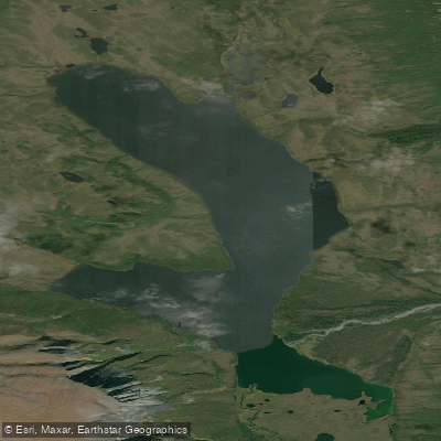
The river parallels the Richardson Highway and Trans-Alaska Pipeline for much of its length, making it one of Alaska's most accessible wilderness rivers, located less than five hours from both Anchorage and Fairbanks. The Main Stem begins at Paxson Lake (Mile 175 Richardson Highway), where paddlers cross three to four miles of lake before reaching the outlet at River Mile 0. The Middle Fork originates at Dickey Lake, accessible either by floatplane or via a challenging series of portages from the Upper Tangle Lakes along the Denali Highway. The West Fork, beginning at Lake Louise or Crosswind Lake, offers the most remote and least-traveled route through exceptional wildlife habitat.
Paddling difficulty ranges from Class I meandering sections to the notorious Canyon Rapids at River Mile 20, a quarter-mile stretch of Class III-IV whitewater that most paddlers portage via a well-marked 200-yard trail. The river features Class II rapids in the initial three miles below Paxson Lake outlet (gradient of 38 feet per mile), followed by slower water to the Middle Fork confluence. Below Canyon Rapids, eight miles of Class II-III boulder rapids demand attention before the river calms. The West Fork confluence at River Mile 39 marks the transition to predominantly Class I water continuing to Sourdough Creek Campground and beyond.
The Gulkana provides world-class fishing for Arctic grayling averaging 8-16 inches, with excellent opportunities for rainbow trout, lake trout, whitefish, king salmon, and red salmon. The June through August season offers prime grayling fishing, while July brings salmon runs that attract both anglers and brown bears, requiring proper food storage and camp hygiene.
Historically, the Ahtna Indians were the earliest known inhabitants, using the frozen river as a winter travel corridor. Around 1910, miners traversed the West and Middle Forks to reach the Denali Mining District. The first seven miles of the Middle Fork below Dickey Lake lie within the Tangle Lakes Archaeological District, listed on the National Register of Historic Places.
The most popular trip covers 47 river miles from Paxson Lake to Sourdough Creek Campground (Mile 147.5 Richardson Highway) over three to four days. Extended trips continue another 30-35 miles to the Richardson Highway Bridge (Mile 126.9). The Middle Fork from Dickey Lake to Sourdough spans 72 miles, requiring six to seven days. Key access points include Paxson Lake Campground, Sourdough Creek Campground, Poplar Grove Campground (Mile 136.4), and the Richardson Highway Bridge, with additional trail access at Mile 169 (Meiers Lake-Middle Fork trail) and Mile 161 (Haggard Creek trail).
Water access, boat ramps & amenities
Learn how to get on Gulkana River. Uncover great paddling access points, boat ramps, and all the facilities you need for an unforgettable day on the water. Some locations shown may border or include private property. Always check property boundaries and applicable regulations before visiting. PaddleWays's Public & Private Land layer can help you plan your access with confidence.
Paddle smarter with real-time insights
Whether you're en route and conditions shift or you're looking for the best spot based on current flows, we enable you to make informed decisions on the fly.








Find Places to Paddle

Over 400,000 Places to Paddle
Every user gets free access to launch points, boat ramps, and public property parcels.


Water and weather conditions (10 day forecast)
See the best times to paddle Gulkana River and check the forecast before you go.
GULKANA R AT SOURDOUGH AK
Explore Alaska waters
Top paddling waters
Popular Cities
Loading popular cities...
Explore near Gulkana River
Access points
Nearby waters
More in Alaska

Smarter Paddling Starts in the App.
Paddleways gives you everything you need to plan smarter, paddle better, and own every trip from first launch to takeout.