Paddling in Mammoth Cave National Park
- National Park
- Open 24 hours
- Lakes
- 2
- Rivers
- 28
- Access
- 0
- Boat Ramps
- 4
- Shops
- 0
Mammoth Cave National Park is cave country first, but the surface holds real paddling water — two rivers threading through a landscape of limestone bluffs, sandbars, and floodplain forest in south-central Kentucky. The Green River is the main event.
It runs 25 miles through the park, averaging around 200 feet wide and 10 feet deep, though pools run considerably deeper. Flatwater, but not slack: the 2016 failure and subsequent removal of Lock and Dam No.
6 downstream dropped water levels and pushed current speeds up, and the river moves with purpose now.
More than 150 fish species and over 70 mussel species live here, many of them threatened or endangered — context worth carrying when you're dragging a hull across a sandbar. The Nolin River adds 7.
5 miles, entering from the Tailwater Recreation Area below Nolin River Lake and Dam before joining the Green inside the park.
Water releases from that dam can change levels fast, and both rivers are capable of rising 20 to 50 feet in the hours after a significant rain event. Check conditions before you put in, and store boats on high ground overnight.
The rivers are dotted with sandbars and islands, and the park allows camping on islands, in the floodplain, and at Houchin Ferry Campground along the river.
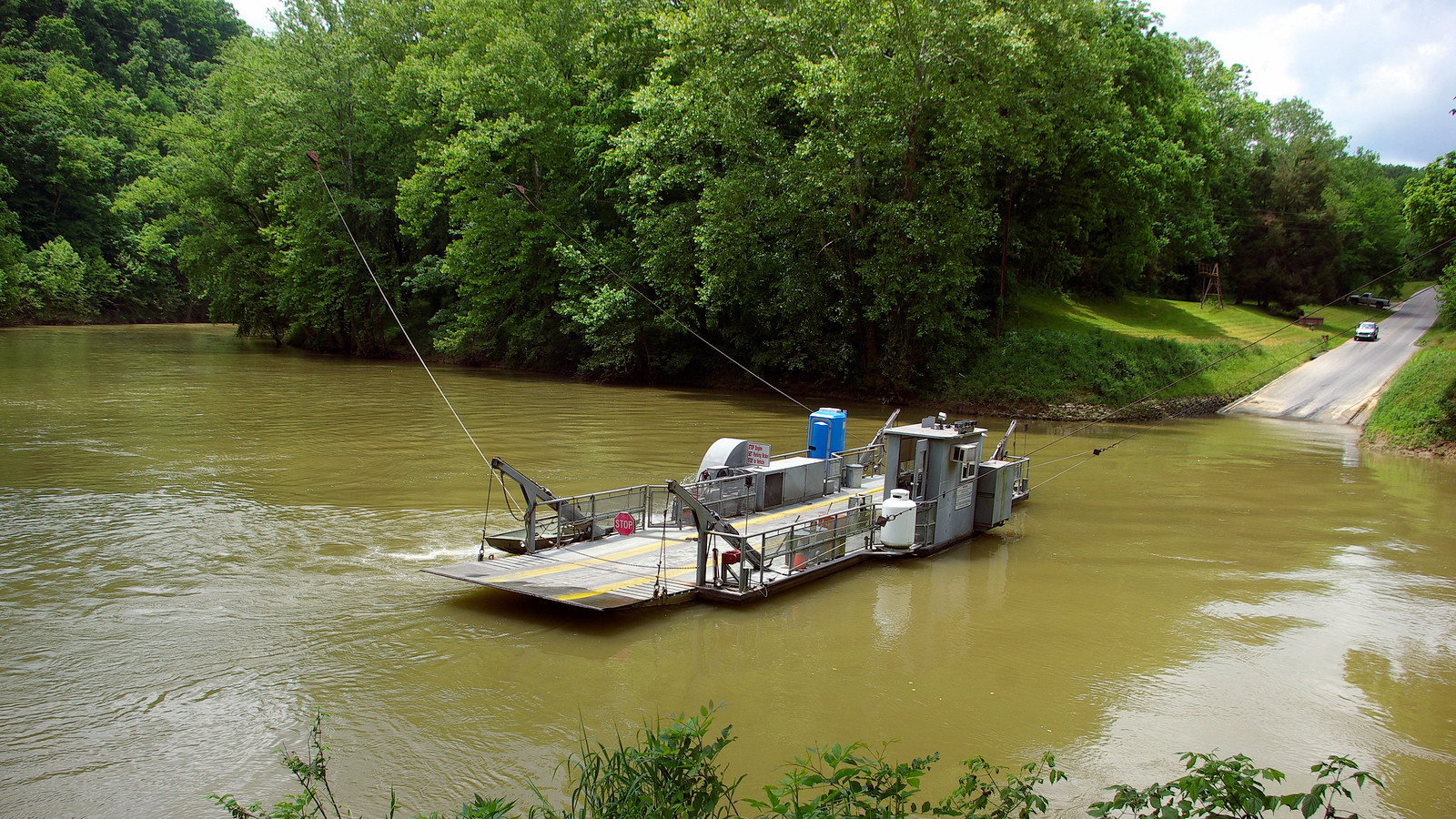
Submerged trees, drifting debris, and the park's operating ferry are the hazards to watch; the ferry crosses the Green and shares the water with paddlers.
Cell service is limited throughout the park, and emergency response can take 45 to 90 minutes or longer — self-sufficiency matters here more than on rivers closer to town.
Private outfitters operate inside the park under commercial use authorization from the National Park Service, running rentals and shuttles on both rivers.
If you're bringing your own boat, shuttle logistics are manageable with the access points that exist, but confirm current put-in and take-out conditions before you go.
The Green River's biodiversity makes it one of the more ecologically significant flatwater runs in the eastern United States. Paddle it like it.
Water and weather conditions (10 day forecast)
See the best times to paddle Mammoth Cave National Park and check the forecast before you go.
No forecast data available.
Park alerts & road status
Closures and conditions Mammoth Cave National Park has posted, from the National Park Service.
Checking the park's alerts…
Hours & fees
When Mammoth Cave National Park is open and what it costs to get in, from the National Park Service.
Hours
Open 24 hoursMammoth Cave National Park is open 24-hours a day, although services such as cave tours and the visitor center are limited after-hours. There is no gate at the park entrance. Please note that camping is only possible either in designated campgrounds or backcountry campsites with a valid reservation or permit.
Entrance fees
No entrance fee is listed for this park.
Paddle smarter with real-time insights
Whether you're en route and conditions shift or you're looking for the best spot based on current flows, we enable you to make informed decisions on the fly.







Paddling near Mammoth Cave National Park
Loading...
Other parks in Kentucky
Gateway towns
Where to base yourself for paddling in Mammoth Cave National Park.
The main visitor hub just outside the park, with hotels, restaurants, and easy access to the park entrance.
A small town near the park's north entrance, offering lodging and services for cave visitors.
Seat of Edmonson County and gateway to the park's Brownsville side entrance, with nearby lodging options.
Mammoth Cave National Park paddling rules
The park's own rules, on top of Kentucky licenses and regulations. Limits, fees and closures change, so check the park's page before you go.

Always Wear Your Life Jacket
Children 12 and under must wear a properly fitted, US Coast Guard-approved PFD at all times on the river. All paddlers are strongly encouraged to wear one, and every person onboard must have a Type I, II, or III PFD available.

Know Before You Launch
Check river levels and the weather forecast before putting in. Water can rise 20 to 50 feet within hours of a rain event, and currents can turn swift without warning.

Secure Your Watercraft
Store canoes and gear on high ground and secure your watercraft whenever it is unattended or left overnight to prevent it from being swept away.

Commercial Outfitters Need Authorization
Any business renting canoes or kayaks on park waters must hold a commercial use authorization from the National Park Service. Use only authorized outfitters.
Explore Mammoth Cave National Park
Top paddling waters
Popular Cities
Loading popular cities...

Smarter Paddling Starts in the App.
Paddleways gives you everything you need to plan smarter, paddle better, and own every trip from first launch to takeout.