Río Pichanas
Río Pichanas
- Boat Ramps
- 0
- Access Points
- 0
- Campsites
- 0
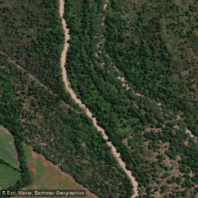
The Río Pichanas flows through the northwest of Córdoba province in the Departamento Minas, draining a catchment of approximately 1,300 km² that includes the Pampa de Pocho, the Cumbres de Gaspar, and Salsacate. The river originates west of the Cumbres de Gaspar, collecting water from the eastern slopes of the Sierras de Guasapampa and Serrezuela, and eventually drains toward the Salinas Grandes depression. The river's primary paddling interest centers on the Dique Pichanas, a concrete buttress dam completed in 1978 that impounds a reservoir of 440 hectares. The dam stands 53.30 meters high with a crest length of 258 meters and a spillway capacity of 66 Hm³.
The reservoir sits roughly 150 kilometers from Córdoba Capital and approximately 17 kilometers from Villa de Soto. Access is available via Ruta Nacional 38 near the locality of Espinillo, which leads to the dam face via provincial route A-193. An alternative entry point is from La Higuera on Ruta Provincial 15, which provides access to the area where the Río Salsacate enters the lake.
Non-motorized water sports are explicitly permitted on the reservoir, making it a viable destination for kayaking and similar paddle craft. The surrounding landscape is characterized by native woodland, with quebracho colorado and orco quebracho among the dominant species. The reservoir supports populations of tararira and pejerrey, and fishing activity is common on the water, which paddlers should be aware of when planning routes.
For those requiring overnight facilities, Villa de Soto offers cabin complexes, hotels, and restaurants within a short distance of the reservoir. The reservoir is managed by the Dirección de Recursos Hídricos of Córdoba province, with its primary purposes being irrigation and flood attenuation.
Water access, boat ramps & amenities
Learn how to get on Río Pichanas. Uncover great paddling access points, boat ramps, and all the facilities you need for an unforgettable day on the water. Some locations shown may border or include private property. Always check property boundaries and applicable regulations before visiting. PaddleWays's Public & Private Land layer can help you plan your access with confidence.
Paddle smarter with real-time insights
Whether you're en route and conditions shift or you're looking for the best spot based on current flows, we enable you to make informed decisions on the fly.







Córdoba licenses and regulations

Find Places to Paddle

Over 400,000 Places to Paddle
Every user gets free access to launch points, boat ramps, and public property parcels.


Water and weather conditions (10 day forecast)
See the best times to paddle Río Pichanas and check the forecast before you go.
No forecast data available.
Paddling near Río Pichanas
Río Quilipo
Río Cruz del Eje
Embalse de Cruz del Eje
Río Yuspe
Río Pintos
Embalse San Roque
Río Primero (Suquía)
Arroyo Ciénaga del Coro
Arroyo Áspero
Explore Córdoba waters
Top paddling waters
No waters available right now.
Popular Cities
Loading popular cities...
Explore near Río Pichanas

Smarter Paddling Starts in the App.
Paddleways gives you everything you need to plan smarter, paddle better, and own every trip from first launch to takeout.