Río Salado
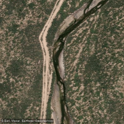
Río Salado
- Boat Ramps
- 0
- Access Points
- 0
- Campsites
- 0
The Río Salado in Mendoza, Argentina is a mountain river located in the Malargüe region, approximately 50 kilometers from the city of Malargüe. The upper section of the river, known as the Salado Superior, is the primary stretch used for paddling and is rated Class 2+ on the International Scale of River Difficulty, making it accessible to both adults and children with appropriate supervision and guidance.
To reach the put-in, paddlers travel north from Malargüe along Route 40 for roughly 20 kilometers, then turn onto Route 222, which leads toward Las Leñas Ski Resort. The access point is near the district of Los Molles, a small settlement with cabin accommodations available. From there, a path leads down to the riverbank. The rafting circuit covers approximately 10 kilometers in total.
The river features falls and rapids characteristic of Andean mountain rivers. Organized rafting operations on this stretch provide participants with dry suits, helmets, life jackets, and neoprene leg warmers, reflecting the cold water temperatures that warrant full thermal protection. The surrounding landscape is defined by the scale of the Andean mountain range.
Given the proximity to Las Leñas and the character of the southern Mendoza mountains, the river runs through a remote and expansive high-altitude environment. Outfitters operating guided trips from Los Molles offer commercial services and local logistical support for paddlers.
Water access, boat ramps & amenities
Learn how to get on Río Salado. Uncover great paddling access points, boat ramps, and all the facilities you need for an unforgettable day on the water. Some locations shown may border or include private property. Always check property boundaries and applicable regulations before visiting. PaddleWays's Public & Private Land layer can help you plan your access with confidence.
Paddle smarter with real-time insights
Whether you're en route and conditions shift or you're looking for the best spot based on current flows, we enable you to make informed decisions on the fly.







La Pampa licenses and regulations

Find Places to Paddle

Over 400,000 Places to Paddle
Every user gets free access to launch points, boat ramps, and public property parcels.


Water and weather conditions (10 day forecast)
See the best times to paddle Río Salado and check the forecast before you go.
Desaguadero - Canalejas
All Flow Stations
Explore La Pampa waters
Top paddling waters
No waters available right now.
Popular Cities
Loading popular cities...
Explore near Río Salado

Smarter Paddling Starts in the App.
Paddleways gives you everything you need to plan smarter, paddle better, and own every trip from first launch to takeout.