Belubula River
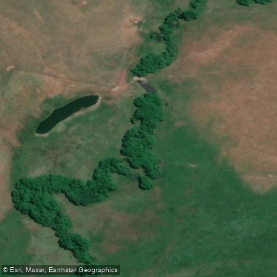
Belubula River
- Boat Ramps
- 0
- Access Points
- 0
- Campsites
- 0
The Belubula River is a significant tributary of the Lachlan River in New South Wales, flowing through a varied landscape that transitions from steep, rugged gorge country in its middle reaches to gentler farming terrain closer to Canowindra. The river drops approximately 586 metres from Carcoar Dam to its junction with the Lachlan River, with the mid-section alone descending around 600 metres over 75 kilometres between Carcoar Dam and Canowindra.
The upper-middle section, accessed from Bakers Shaft Reserve, is a demanding stretch suited only to well-prepared paddlers. The river here is very fast, very narrow, and runs through steep country far removed from public roads and outside assistance. Communications are minimal in this area. About 3.5 kilometres below Bakers Shaft Reserve sits an old weir, originally built to supply water for hydro-electric generators at the historic Junction Reef gold mine. Approximately half a kilometre past the weir, the river drops over falls and steep rapids before passing through a feature known as the Needles (approximately 33° 34' 48" S, 148° 50' 53.2" E) and on toward Cranky Rock. The river through this section is dominated by pool-riffle sequences punctuated by narrow gorges and small falls. Introduced willows and figs are present along the riverbanks.
Access through this middle section requires organising passage through private properties for any support vehicles, and the difference between adequate and excessive water levels is minimal, making timing critical. Water flow depends on discharge from Carcoar Dam or local rainfall. The gauge at Canowindra lists a minimum level of 0.35 metres, a good level of 0.6 metres, and a high level of 1 metre, with a 2-metre flood level. No facilities exist outside the towns of Cowra, Canowindra, Blayney, or Carcoar.
Below Canowindra, the character of the river changes considerably. The river flows through more gentle farming country but can still run fast. Multiple access points exist in this lower section, including the Cherry Tree Fall Bridge approximately 8 kilometres above John Grant Bridge, the John Grant Bridge itself, Cullanes Bridge on Settlement Bridge Road, and a bridge on Rivers Road as a second access point below Canowindra. The area around Bakers Shaft Reserve includes a walking trail connecting to Belubula Falls. The broader region is notable for Cliefden Caves, a significant cave system near Cranky Rock, and Canowindra is known for its Devonian fish fossil museum.
Water access, boat ramps & amenities
Learn how to get on Belubula River. Uncover great paddling access points, boat ramps, and all the facilities you need for an unforgettable day on the water. Some locations shown may border or include private property. Always check property boundaries and applicable regulations before visiting. PaddleWays's Public & Private Land layer can help you plan your access with confidence.
Paddle smarter with real-time insights
Whether you're en route and conditions shift or you're looking for the best spot based on current flows, we enable you to make informed decisions on the fly.








Find Places to Paddle

Over 400,000 Places to Paddle
Every user gets free access to launch points, boat ramps, and public property parcels.


Water and weather conditions (10 day forecast)
See the best times to paddle Belubula River and check the forecast before you go.
No forecast data available.
Paddling near Belubula River
Macquarie River
Turon River
Lake Burrendong
Lachlan River
Cudgegong River
Abercrombie River
Browns Creek
Goobang Creek
Lake Wyangala
Explore New South Wales waters
Top paddling waters
No waters available right now.
Popular Cities
Loading popular cities...
Explore near Belubula River

Smarter Paddling Starts in the App.
Paddleways gives you everything you need to plan smarter, paddle better, and own every trip from first launch to takeout.