Bonville
- Saltwater
- Beach
Bonville
- Saltwater
- Beach
- Sq. miles
- 0.8
- Boat Ramps
- 0
- Access Points
- 0
- Campsites
- 0
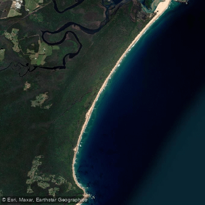
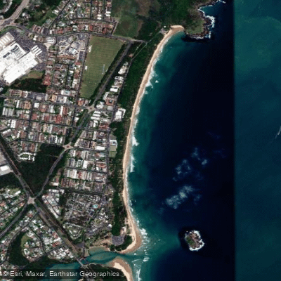
Bonville Beach is a long, unpatrolled beach stretching for 6.8 kilometers from Bonville Head south to Bundagen Head, bordered by Bongil Bongil National Park. The primary paddling access is via Bonville Creek, a tidal saltwater estuary that meets the ocean at the northern end of the beach. The main launch point for paddlers is the Bonville Creek boat ramp, which provides access to the lower and upper estuary. For those launching directly from the beach, it is important to note that the beach is not patrolled by lifeguards. The mouth of Bonville Creek presents a significant hazard; tidal currents can be very strong, and extreme care is advised when wading across the creek mouth during outgoing tides. The use of surf craft or flotation devices is not recommended at the creek mouth. The beach offers no specific facilities for paddlers, and dogs are not permitted on the sand.
Once on the water, Bonville Creek provides a sheltered and tranquil paddling environment suitable for all skill levels, including canoeing, kayaking, and stand-up paddleboarding. The estuary is surrounded by native bushland and forms part of Bongil Bongil National Park, creating a sense of remoteness despite proximity to Sawtell village. The area is renowned for birdwatching, with common sightings including cormorants, whistling kites, ospreys, kingfishers, rainbow bee-eaters, and shorebirds like little terns and pied oystercatchers near the creek mouth. Other wildlife may include stingrays and crabs. For a longer trip, paddlers can journey upstream into Pine Creek, which requires at least two hours of paddling to reach Burma Road. This route passes through riparian vegetation and serene countryside but may involve portaging over fallen trees. Road access to the upper take-out point may require a 4WD vehicle.
Water access, boat ramps & amenities
Learn how to get on Bonville. Uncover great paddling access points, boat ramps, and all the facilities you need for an unforgettable day on the water. Some locations shown may border or include private property. Always check property boundaries and applicable regulations before visiting. PaddleWays's Public & Private Land layer can help you plan your access with confidence.
Paddle smarter with real-time insights
Whether you're en route and conditions shift or you're looking for the best spot based on current flows, we enable you to make informed decisions on the fly.








Find Places to Paddle

Over 400,000 Places to Paddle
Every user gets free access to launch points, boat ramps, and public property parcels.


Tides, wind & water conditions (10 day forecast)
On open water, wind and tide matter as much as the weather. See the best times to paddle Bonville and check the marine forecast before you launch.
Loading tide predictions…
Paddling near Bonville
Bellinger River
Bobo River
Coffs Harbour Creek
Kalang River
Little Nymboida River
Bonville Creek
Pine Creek
Park Beach
Coffs Creek
Explore New South Wales waters
Top paddling waters
No waters available right now.
Popular Cities
Loading popular cities...
Explore near Bonville

Smarter Paddling Starts in the App.
Paddleways gives you everything you need to plan smarter, paddle better, and own every trip from first launch to takeout.