Limeburners Creek
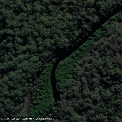
Limeburners Creek
- Boat Ramps
- 0
- Access Points
- 0
- Campsites
- 0
Limeburners Creek lies on the northern edge of Port Macquarie on the NSW Mid North Coast, flowing through what was declared a nature reserve in 1971 — the first on the NSW north coast — and later upgraded to national park status in 2010. The area contains important Aboriginal sites with a known period of occupation spanning 5,000 to 6,000 years, and has a history of oyster farming in which sandstone rocks, brought to Port Macquarie as ballast on sailing ships, were used as platforms to catch oyster spawn at low tide.
The creek is tidal, and paddlers typically access it from the Hastings River, paddling a couple of kilometres downstream before turning north into Limeburners Creek. The entrance area features oyster farms that require some navigation, after which the creek enters the national park and progressively narrows. The character of the waterway changes constantly, moving between open stretches and narrow, tunnel-like sections, with fallen trees and other obstacles adding variety. Vegetation along the banks includes grey and river mangroves, saltgrass meadows, casuarinas, melaleucas, eucalypts, and clusters of elk and stag ferns. Further upstream, the trees thin out as the creek approaches Saltwater Lake. There are two lakes along the route, with Saltwater Lake being a noted turnaround point for many paddlers.
Timing a paddle with an incoming tide is strongly recommended, as the tidal current provides meaningful assistance heading upstream and ideally reverses to assist the return journey. The full return trip to Saltwater Lake is approximately 25 kilometres and takes around five hours. Fallen trees across the creek may require portaging or scrambling, so paddlers should be prepared for minor obstacles. Drone flying is not permitted within the national park section of the route.
The creek passes through a range of environments, from open bays to enclosed mangrove tunnels, with abundant birdlife audible throughout. The area around Shallow Bay, crossed at the start and end of the paddle, can become very shallow depending on the tide, so timing the return crossing appropriately is worth considering.
Water access, boat ramps & amenities
Learn how to get on Limeburners Creek. Uncover great paddling access points, boat ramps, and all the facilities you need for an unforgettable day on the water. Some locations shown may border or include private property. Always check property boundaries and applicable regulations before visiting. PaddleWays's Public & Private Land layer can help you plan your access with confidence.
Paddle smarter with real-time insights
Whether you're en route and conditions shift or you're looking for the best spot based on current flows, we enable you to make informed decisions on the fly.








Find Places to Paddle

Over 400,000 Places to Paddle
Every user gets free access to launch points, boat ramps, and public property parcels.


Water and weather conditions (10 day forecast)
See the best times to paddle Limeburners Creek and check the forecast before you go.
No forecast data available.
Paddling near Limeburners Creek
Hastings River
Herons Creek
Lake Cathie/Innes
Camden Haven River
Queens Lake
North Shore Beach
Wilson River
Maria River
Lighthouse Beach
Explore New South Wales waters
Top paddling waters
No waters available right now.
Popular Cities
Loading popular cities...
Explore near Limeburners Creek

Smarter Paddling Starts in the App.
Paddleways gives you everything you need to plan smarter, paddle better, and own every trip from first launch to takeout.